 Arctic Biodiversity Data Service - ABDS Catalog
Hydrography
Type of resources
Available actions
Topics
Keywords
Contact for the resource
Provided by
Years
Formats
Representation types
Update frequencies
status
Scale
-

Although the circumpolar countries endeavor to support monitoring programs that provide good coverage of Arctic and subarctic regions, this ideal is constrained by the high costs associated with repeated sampling of a large set of lakes and rivers in areas that often are very remote. Consequently, freshwater monitoring has sparse, spatial coverage in large parts of the Arctic, with only Fennoscandia and Iceland having extensive monitoring coverage of lakes and streams Figure 6-1 Current state of monitoring for lake FECs in each Arctic country. State of the Arctic Freshwater Biodiversity Report - Chapter 6 - Page 93 - Figure 6-1
-
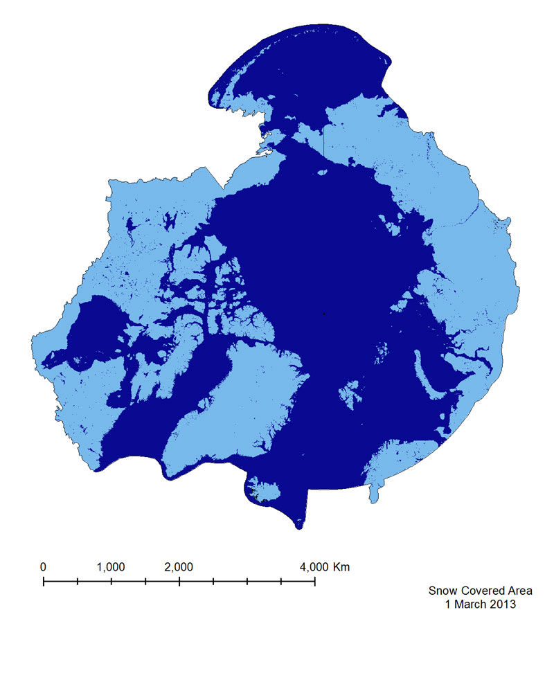
The Snow Covered Area product is based on a Normalized Difference Snow Index(NDSI), which is similar to NDVI, but exploits different bands in the equation (Equation 3),namely Green (Band 4) and Short Wavelength Near-infrared (SWNIR, Band 6). It isimportant to note that the Band 6 sensor on MODIS Aqua malfunctioned shortly after launch,so Snow Covered Area from the Aqua sensor is calculated using Bands 3 and 7. This mayintroduce errors in identifying snow in vegetated areas, as the use of Band 7 results in falsesnow detection. For this reason the MODIS Terra product has been provided for the CAFF-system.
-
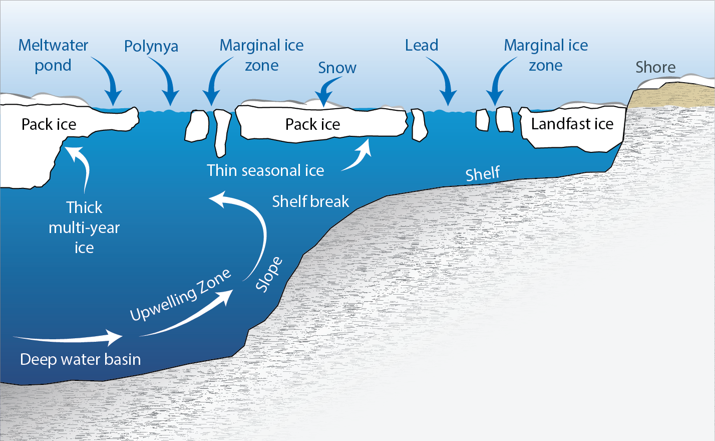
Some features of the sea ice environment. Marine areas seasonally or permanently covered by sea ice are a globally unique habitat. Ice edges and open water areas favour wind-driven mixing of the seawater that enhances local production and can create biological hotspots. Adapted from Eamer et al. (2013). STATE OF THE ARCTIC MARINE BIODIVERSITY REPORT - <a href="https://arcticbiodiversity.is/marine" target="_blank">Chapter 2</a> - Page 20 - Box Fig 2.1
-
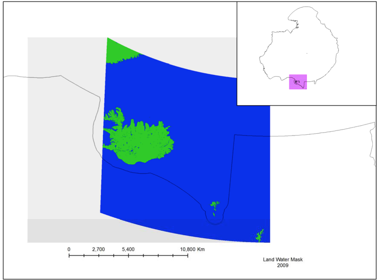
The MODIS Land Water Mask is created from MODIS 250 m imagery incombination with Shuttle Radar Topography Mission (SRTM) Water Body Data (SWBD) tocreate a global map of surface water at 250 m spatial resolution. Currently, only one mapexists, created in 2009 by Carroll et al. (2009). Because only one MODIS-based map exists,an analysis of surface water change is not possible at this time.
-
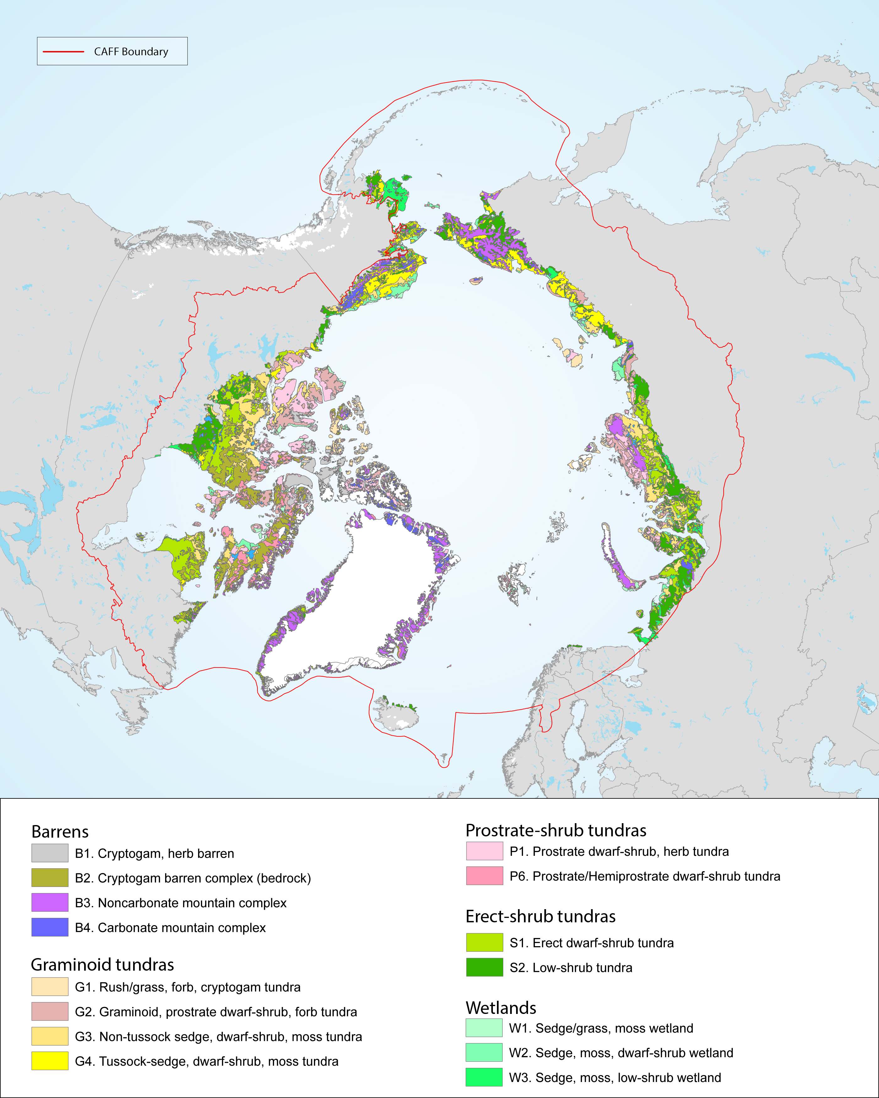
There is a great variation and heterogeneity among terrestrial Arctic ecosystems. This is further described as biogeographical areas in the Annotated Checklist of the Pan-Arctic Flora (Elven et al. 2020), as vegetation zones (Walker et al. 2005, Raynolds et al 2019) or as ecoregions recognised by Terrestrial Ecoregions of the World (Olson et al. 2001). The START focuses on high and low Arctic regions consistent with the CAVM’s subzones A to E, as shown in Figure 1-2 and Figure 2-1 STATE OF THE ARCTIC TERRESTRIAL BIODIVERSITY REPORT - Chapter 2 - Page 19 - Figure 2.1
-
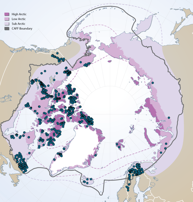
Sites of existing lake biotic and abiotic data as compiled by the Freshwater Expert Monitoring Group (FEMG) of the Circumpolar Biodiversity Monitoring Group (CBMP) Published in the CBMP Freshwater Brochure 2013 http://www.caff.is/monitoring-series/view_document/277-arctic-freshwater-biodiversity-monitoring-plan-brochure
-
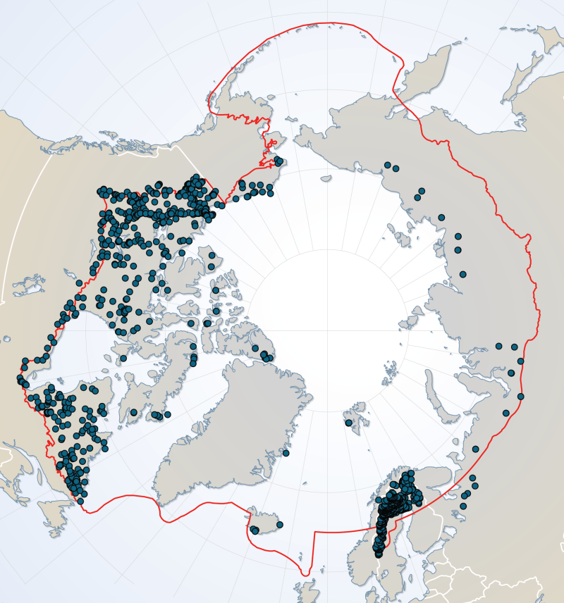
River dataset showing location of study sites in rivers for the Arctic Freshwater Biodiversity Monitoring Plan. Published in the Arctic Freshwater Monitoring Plan Brochure released in 2013 http://www.caff.is/monitoring-series/view_document/277-arctic-freshwater-biodiversity-monitoring-plan-brochure
-
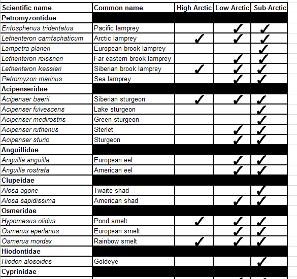
Appendix 6.1.1. Freshwater and diadromous fish species by area of occurrence within the High Arctic, Low Arctic and sub-Arctic. Appendix 6.1.2. Freshwater and diadromous fishes of the Palearctic and Nearctic regions. Appendix 6.1.3. Occurrence of freshwater and diadromous fishes in the Arctic and sub-Arctic regions of the seven geographical regions referred to in the main text. Appendix 6.1.4. Freshwater and diadromous fish species status summary for species assessed at some level of risk by country or region