 CAFF - Arctic Biodiversity Data Service (ABDS)
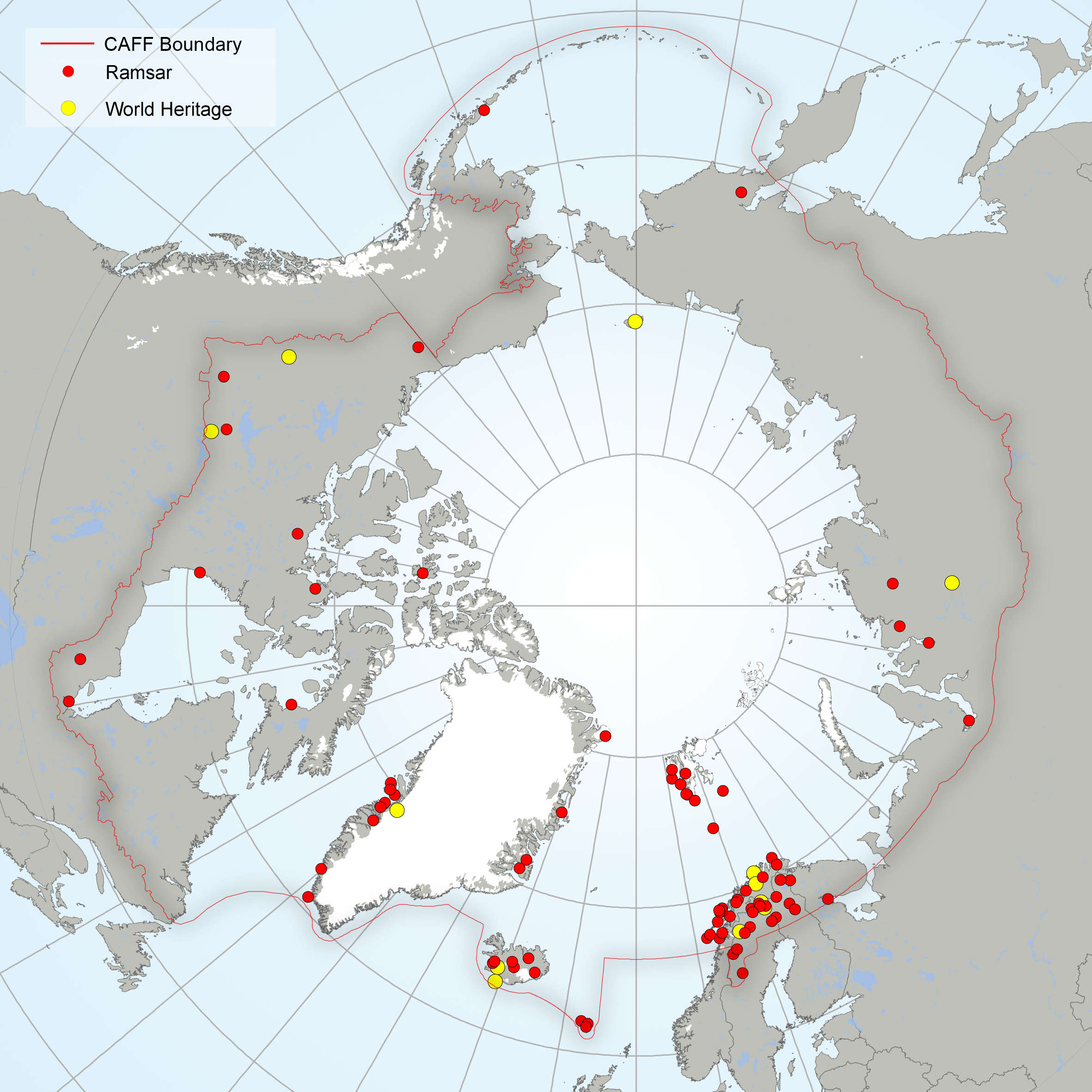
Distribution of Ramsar and World Heritage sites within the CAFF boundary, 2016.
Within the CAFF boundary there are 92 protected areas recognised under global international conventions. These include 12 World Heritage sites3 (three of which have a marine component) and 80 Ramsar sites, which together cover 0.9% (289,931 km2) of the CAFF area (Fig. 4). Between 1985 and 2015, the total area covered by Ramsar sites4 almost doubled, while the total area designated as World Heritage sites increased by about 50% in the same time period (Fig. 5).
ARCTIC PROTECTED AREAS - INDICATOR REPORT 2017
Simple
- Date (Publication)
- 2017-05
- Status
- Completed
Point of contact
- Maintenance and update frequency
- As needed
- Theme
-
-
Protecded Area
-
World Heritage
-
UNESCO
-
- Place
-
-
Ramsar
-
- Access constraints
- Copyright
- Use constraints
- otherRestictions
- Spatial representation type
- Vector
- Language
- English
- Character set
- UTF8
- Topic category
-
- Boundaries
))
- Supplemental Information
-
You can customize the template to suit your needs. You can add
and remove fields and fill out default information (e.g. contact details).
Fields you can not change in the default view may be accessible in the more
comprehensive (and more complex) advanced view. You can even use the XML editor
to create custom structures, but they have to be validated by the system, so
know what you do :-)
- Reference system identifier
- WGS 1984
Digital transfer options
- OnLine resource
- Hierarchy level
- Dataset
Conformance result
- Date (Publication)
Metadata
- File identifier
- 994d78dd-7bbd-4fe6-99a6-3a724ad4fd9e XML
- Metadata language
- English
- Character set
- UTF8
- Date stamp
- 2026-02-19T17:48:33.610628Z
- Metadata standard name
-
ISO 19115:2003/19139
- Metadata standard version
-
1.0
)))