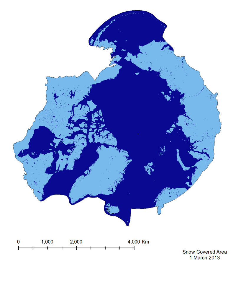
Snow Covered Area
The Snow Covered Area product is based on a Normalized Difference Snow Index(NDSI), which is similar to NDVI, but exploits different bands in the equation (Equation 3),namely Green (Band 4) and Short Wavelength Near-infrared (SWNIR, Band 6).
It isimportant to note that the Band 6 sensor on MODIS Aqua malfunctioned shortly after launch,so Snow Covered Area from the Aqua sensor is calculated using Bands 3 and 7.
This mayintroduce errors in identifying snow in vegetated areas, as the use of Band 7 results in falsesnow detection. For this reason the MODIS Terra product has been provided for the CAFF-system.
Simple
- Alternate title
- MOD10CM
- Date (Publication)
- 2014-12-16
- Date (Revision)
- Date (Creation)
- Credit
- Conservation of Arctic Flora and Fauna (CAFF www.caff.is) working group of the Arctic Council
http://caff.is
- Hours of service
- 08:00 - 16:00 GMT
- Maintenance and update frequency
- Irregular
- Keywords
-
- snow cover
- CAFF
- Keywords
-
- MOD10CM
- NDSI
- remote sensing
- GEMET - INSPIRE themes, version 1.0
-
- Hydrography
- Orthoimagery
- Land cover
- Metadata language
- English
))
- Reference system identifier
- EPSG / 102017
- OnLine resource
-
2019_SnowCoveredArea
(
OGC:WMS
)
2019_SnowCoveredArea
- OnLine resource
-
Snow_Covered-Area.jpg
(
WWW:DOWNLOAD-1.0-http--download
)
Image
- OnLine resource
-
Dataset
(
WWW:LINK-1.0-http--link
)
Dataset
- Hierarchy level
- Dataset
Conformance result
- Date (Publication)
- File identifier
- 26975017-3375-42d3-bca0-d78adceadaa1 XML
- Metadata language
- English
- Character set
- UTF16
- Hierarchy level
- Dataset
- Date stamp
- 2023-02-13T14:01:21
- Metadata standard version
- 1.2
Overviews

Spatial extent
))
Provided by

 CAFF - Arctic Biodiversity Data Service (ABDS)