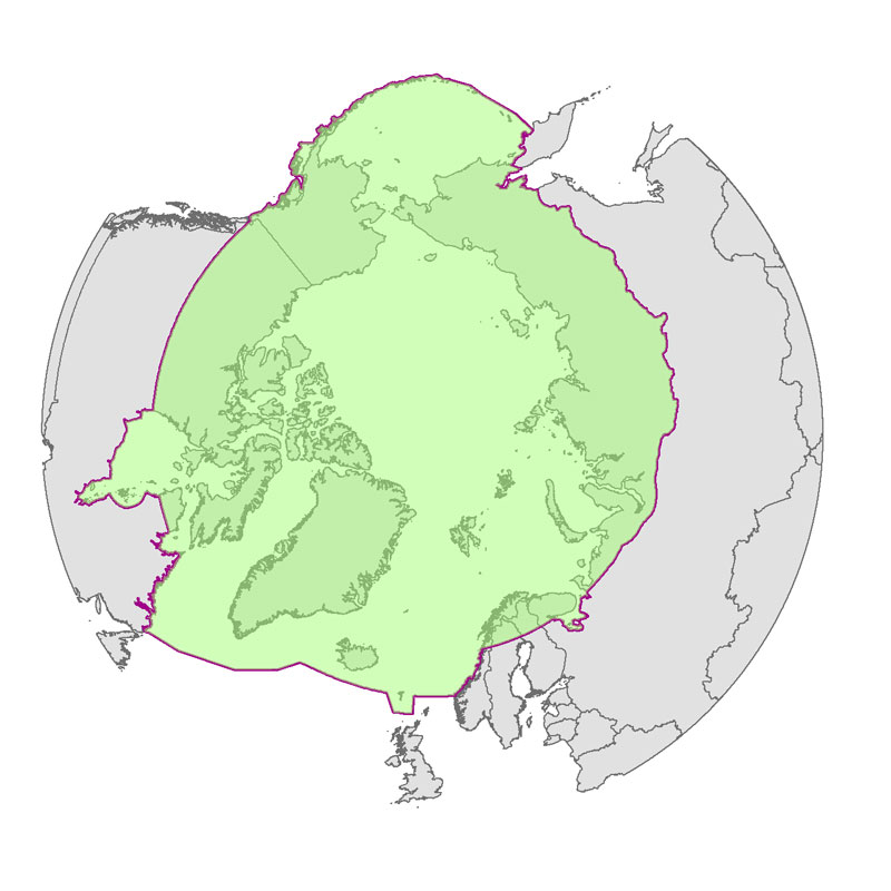
Boundary for Arctic Assessment and Monitoring Programme (AMAP) working group of the Arctic Council
Simple
- Date
- Date (Revision)
- Date (Creation)
- Date (Publication)
- Presentation form
- Digital map
- Credit
- Arctic Assessment and Monitoring Programme (AMAP www.amap.no) working group of the Arctic Council
- Maintenance and update frequency
- As needed
- Theme
-
- boundary
- AMAP
- Keywords
-
- Spatial representation type
- Vector
- Metadata language
- English
- Character set
- UTF8
- Environment description
- Version 6.2 (Build 9200) ; Esri ArcGIS 10.1.1.3143
))
- Reference system identifier
- EPSG / 3408 / 7.11.2
- Topology level
- Geometry only
- Geometric object type
- Composite
- Geometric object count
- 1
- Distribution format
-
-
Shapefile
(
)
-
Shapefile
(
)
- Transfer size
- 0.021
- OnLine resource
-
amap.jpg
(
WWW:DOWNLOAD-1.0-http--download
)
Image
- OnLine resource
-
amaplim_geo_nw
(
OGC:WMS-1.3.0-http-get-capabilities
)
amaplim_geo_nw
- OnLine resource
-
amaplim_lam_poly
(
OGC:WMS-1.3.0-http-get-capabilities
)
amaplim_lam_poly
- OnLine resource
-
AMAP Page
(
WWW:LINK-1.0-http--link
)
Direct link to AMAP dataset
Conformance result
- Date (Publication)
- File identifier
- 9BB31CE7-9AE2-453D-9234-0BAEB5C8A33C XML
- Metadata language
- English
- Character set
- UTF8
- Hierarchy level
- Dataset
- Date stamp
- 2023-02-13T13:58:26
- Metadata standard name
- NAP - Metadata
- Metadata standard version
- 1.2
Overviews

Spatial extent
))
Provided by

 CAFF - Arctic Biodiversity Data Service (ABDS)