 CAFF - Arctic Biodiversity Data Service (ABDS)
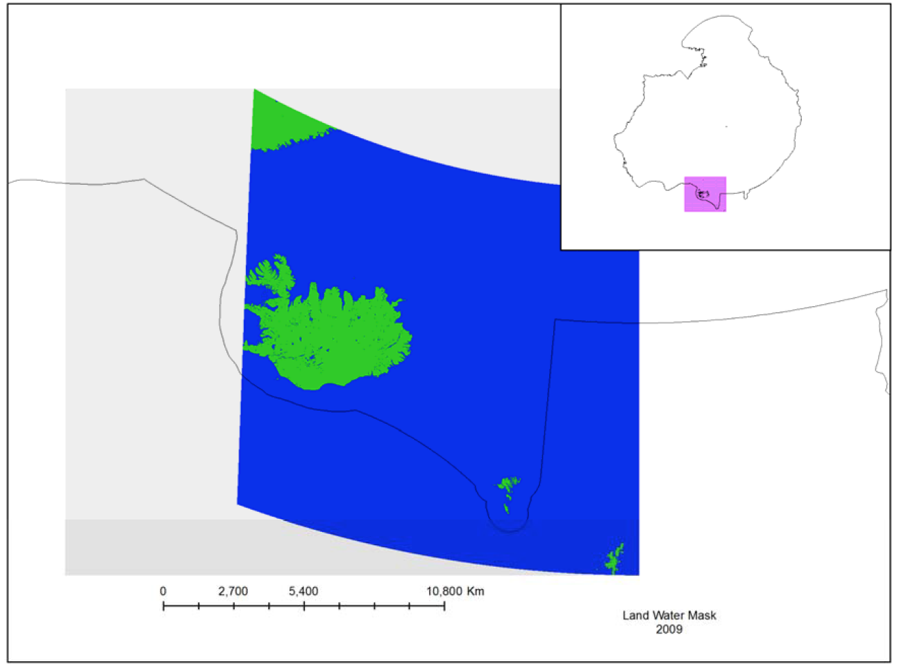
Land Water Mask
The MODIS Land Water Mask is created from MODIS 250 m imagery incombination with Shuttle Radar Topography Mission (SRTM) Water Body Data (SWBD) tocreate a global map of surface water at 250 m spatial resolution.
Currently, only one mapexists, created in 2009 by Carroll et al. (2009). Because only one MODIS-based map exists,an analysis of surface water change is not possible at this time.
Simple
- Alternate title
-
MOD44W
- Date (Publication)
- 2014-12-16
- Date (Revision)
- Date (Creation)
- Citation identifier
- https://geo.abds.is/geonetwork/7fae69b7-387a-43c1-a209-8b135d8645a4
- Citation identifier
- http://geo.abds.is:8081/geonetwork7fae69b7-387a-43c1-a209-8b135d8645a4
- Cited responsible party
-
Organisation name Individual name Electronic mail address Role Conservation of Arctic Flora and Fauna (CAFF)
Point of contact
- Credit
-
Conservation of Arctic Flora and Fauna (CAFF www.caff.is) working group of the Arctic Council
- Maintenance and update frequency
- Unknown
- Keywords
-
-
Water
-
Iceland
-
remote sensing
-
marine
-
- Keywords
-
-
MODIS
-
Topography
-
SRTM
-
SWBD
-
-
GEMET - INSPIRE themes, version 1.0
-
-
Orthoimagery
-
Land cover
-
Hydrography
-
- Language
- English
))
- Reference system identifier
- EPSG / 102017
Digital transfer options
- OnLine resource
-
Protocol Linkage Name WWW:LINK-1.0-http--link
https://abds.is/index.php/indices/land-cover-change-index-edocman
Digital transfer options
- OnLine resource
-
Protocol Linkage Name WWW:DOWNLOAD-1.0-http--download
https://geo.abds.is/geonetwork/srv/api/records/7fae69b7-387a-43c1-a209-8b135d8645a4/attachments/Land_Water_Mask.png Land_Water_Mask.png
- Hierarchy level
- Dataset
Conformance result
- Date (Publication)
- Pass
Metadata
- File identifier
- 7fae69b7-387a-43c1-a209-8b135d8645a4 XML
- Metadata language
- English
- Character set
- UTF16
- Hierarchy level
- Dataset
- Date stamp
- 2026-02-19T17:51:29.360668372Z
- Metadata standard version
-
1.2
- Metadata author
-
Organisation name Individual name Electronic mail address Role Conservation of Arctic Flora and Fauna (CAFF)
Point of contact
)))