 CAFF - Arctic Biodiversity Data Service (ABDS)
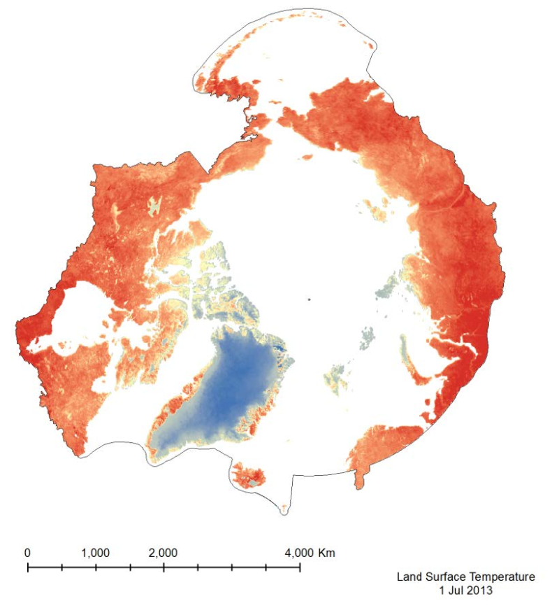
Land Surface Temperature
The MODIS Land Surface Temperature (LST) product provided is a monthlycomposite configured on a 0.05° Climate Model Grid (CMG).
It includes both daytime andnighttime surface temperatures, taken at 11 um and 4 um (night).
This product has beenscaled. To convert the raster values to a Kelvin temperature scale, multiply by a factor of 0.02.
Simple
- Alternate title
-
MOD11C3v05
- Date (Publication)
- 2014-12-16
- Date (Revision)
- Date (Creation)
- Citation identifier
- https://geo.abds.is/geonetwork/a53d7afd-b171-46fd-972d-051805c549b8
- Citation identifier
- http://geo.abds.is:8081/geonetworka53d7afd-b171-46fd-972d-051805c549b8
- Cited responsible party
-
Organisation name Individual name Electronic mail address Role Conservation of Arctic Flora and Fauna (CAFF)
Point of contact
- Credit
-
Conservation of Arctic Flora and Fauna (CAFF www.caff.is) working group of the Arctic Council
- Maintenance and update frequency
- Irregular
- Keywords
-
-
CAFF
-
remote sensing
-
temperature
-
model
-
terrestrial
-
-
GEMET - INSPIRE themes, version 1.0
-
-
Orthoimagery
-
Meteorological geographical features
-
Land cover
-
Atmospheric conditions
-
- Language
- English
))
- Reference system identifier
- EPSG / 102017
Digital transfer options
- OnLine resource
-
Protocol Linkage Name OGC:WMS-1.1.1-http-get-map
https://geo.abds.is/geoserver/arctic_sdi/wms?time=2013-08-01& 2019_SeaSurfaceTemperature
Digital transfer options
- OnLine resource
-
Protocol Linkage Name WWW:DOWNLOAD-1.0-http--download
https://geo.abds.is/geonetwork/srv/api/records/a53d7afd-b171-46fd-972d-051805c549b8/attachments/Landsurfacetemp.jpg Landsurfacetemp.jpg
Digital transfer options
- OnLine resource
-
Protocol Linkage Name WWW:LINK-1.0-http--link
https://abds.is/index.php/indices/land-cover-change-index-edocman
- Hierarchy level
- Dataset
Conformance result
- Date (Publication)
- Pass
Metadata
- File identifier
- a53d7afd-b171-46fd-972d-051805c549b8 XML
- Metadata language
- English
- Character set
- UTF16
- Hierarchy level
- Dataset
- Date stamp
- 2026-02-19T17:47:35.898666523Z
- Metadata standard version
-
1.2
- Metadata author
-
Organisation name Individual name Electronic mail address Role Conservation of Arctic Flora and Fauna (CAFF)
Point of contact
)))