CAVM
Type of resources
Available actions
Keywords
Contact for the resource
Provided by
Years
Representation types
Update frequencies
-

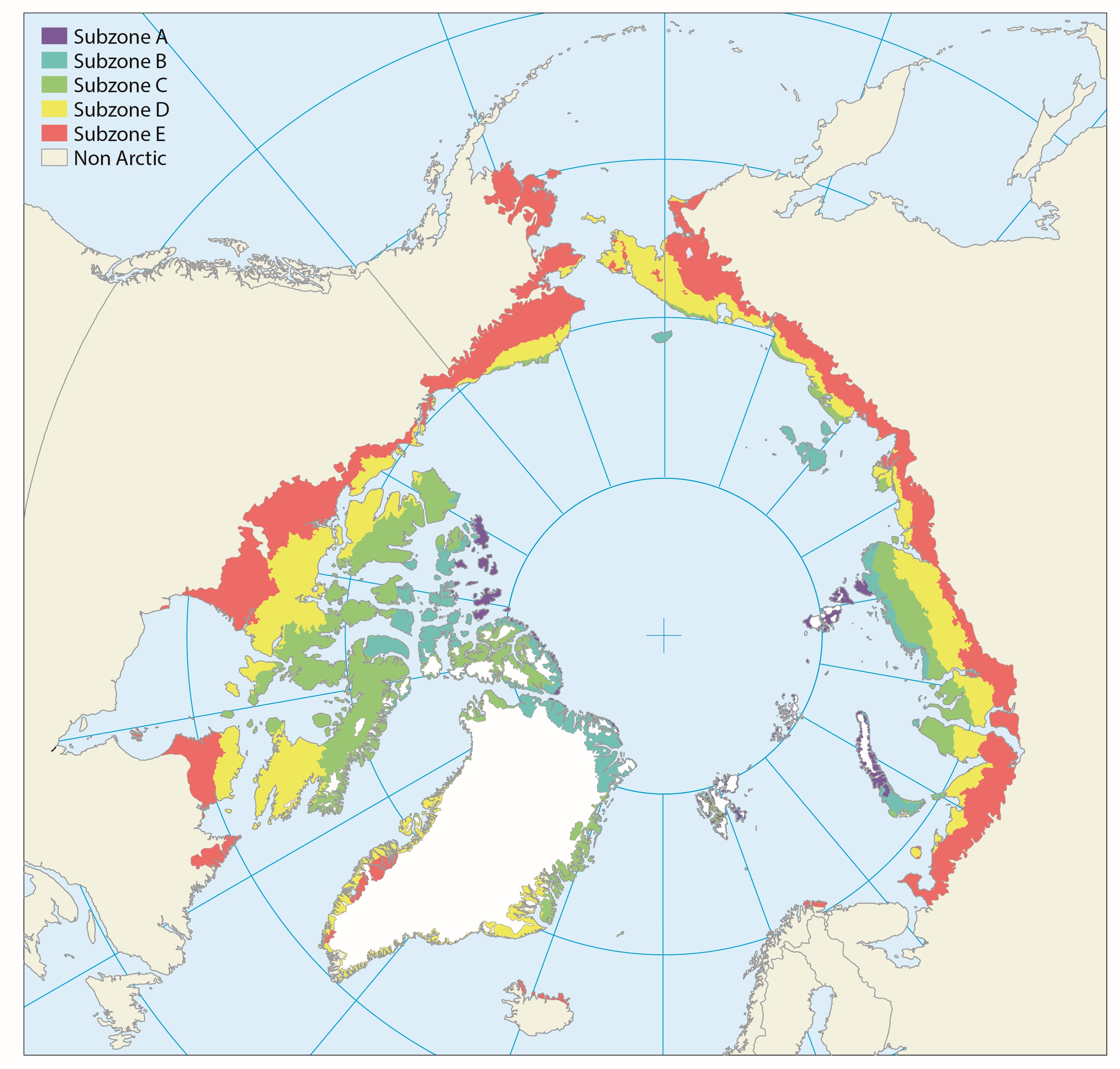
The Arctic territory is roughly subdivided along two main axes in latitudinal subzones (Fig. 9.1) and longitudinal floristic provinces (Fig. 9.2). The latitudinal northsouth axis mainly reflects the present climate gradient divided into five different subzones, which are separated according to climate and vegetation in the lowlands of each zone. Published in the Arctic Biodiversity Assessment, Chapter 9 - released in 2013
-

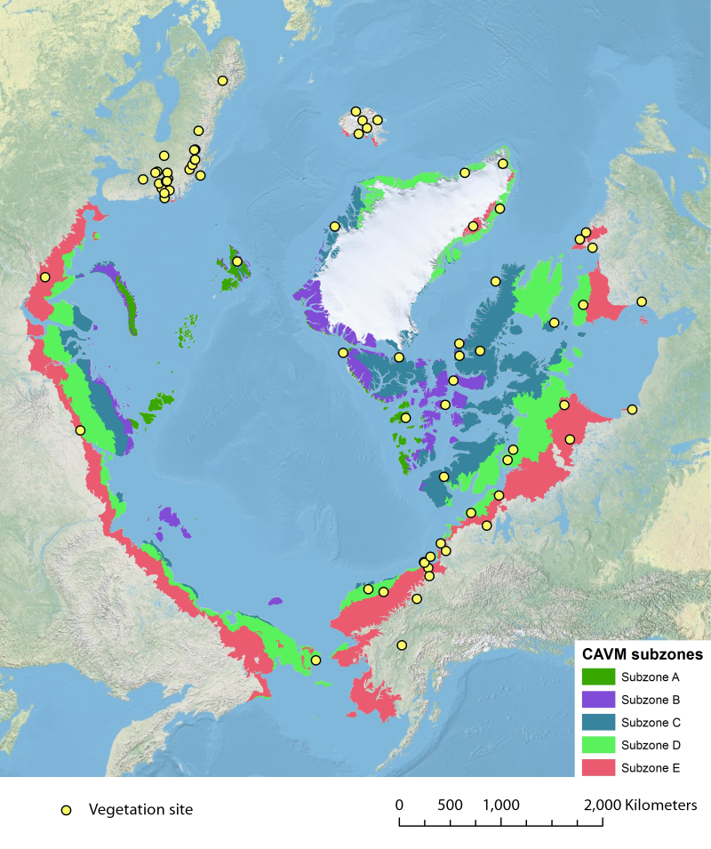
Location of long-term vegetation (including fungi, non-vascular and vascular plants) monitoring sites and programs. Comes from the Arctic Terrestrial Biodiversity Monitoring Plan is developed to improve the collective ability of Arctic traditional knowledge holders, northern communities and scientists to detect, understand and report on long-term change in Arctic terrestrial ecosystems and biodiversity. The report can be seen here http://www.caff.is/publications/view_document/256-arctic-terrestrial-biodiversity-monitoring-plan The monitoring locations are place over the Circumpolar Arctic bioclimate subzones (CAVM Team 2003) http://www.caff.is/flora-cfg/circumpolar-arctic-vegetation-map
 CAFF - Arctic Biodiversity Data Service (ABDS)