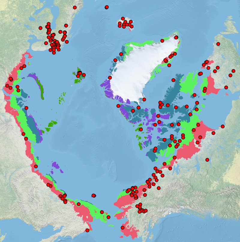
Terrestrial monitoring sites as identified in CBMPs terrestrial monitoring plan
The Arctic Terrestrial Biodiversity Monitoring Plan is developed to improve the collective ability of Arctic traditional knowledge holders, northern communities and scientists to detect, understand and report on long-term change in Arctic terrestrial ecosystems and biodiversity.
Simple
- Date (Creation)
- 2013-10-31T00:00:00
- Date (Revision)
- Date (Publication)
- Presentation form
- Digital map
- Maintenance and update frequency
- Irregular
- Keywords
-
- Terrestrial monitoring sites
- CBMP terrestrial monitoring plan
- Spatial representation type
- Vector
- Metadata language
- English
- Character set
- UTF8
- Topic category
-
- Environment
- Environment description
- Microsoft Windows 7 Version 6.1 (Build 7601) Service Pack 1; Esri ArcGIS 10.1.0.3035
N
S
E
W
))
- Reference system identifier
- ESRI / 102017 / 10.1.0
- Topology level
- Geometry only
- Geometric object type
- Point
- Geometric object count
- 240
- Distribution format
-
-
Shapefile
(
)
-
Shapefile
(
)
- Transfer size
- 0.007
- OnLine resource
-
Terrestrial:CBMP-Terrestrial_Monitoring
(
OGC:WMS
)
WMS Service
- OnLine resource
-
CBMP-Terrestrial_Monitoring.png
(
WWW:DOWNLOAD-1.0-http--download
)
PNG Image
- OnLine resource
-
CBMP-Terrestrial_Monitoring.zip
(
WWW:DOWNLOAD-1.0-http--download
)
Shapefile
Conformance result
- Date (Publication)
- File identifier
- b5875830-781b-4f5a-98fa-52cee9a08487 XML
- Metadata language
- English
- Character set
- UTF8
- Hierarchy level
- Dataset
- Date stamp
- 2023-02-13T13:59:28
- Metadata standard name
- NAP - Metadata
- Metadata standard version
- 1.2
Overviews

large_thumbnail
Spatial extent
N
S
E
W
))
Provided by

Associated resources
Not available
 CAFF - Arctic Biodiversity Data Service (ABDS)