river
Type of resources
Available actions
Topics
Keywords
Contact for the resource
Provided by
Years
Formats
Representation types
Update frequencies
status
-

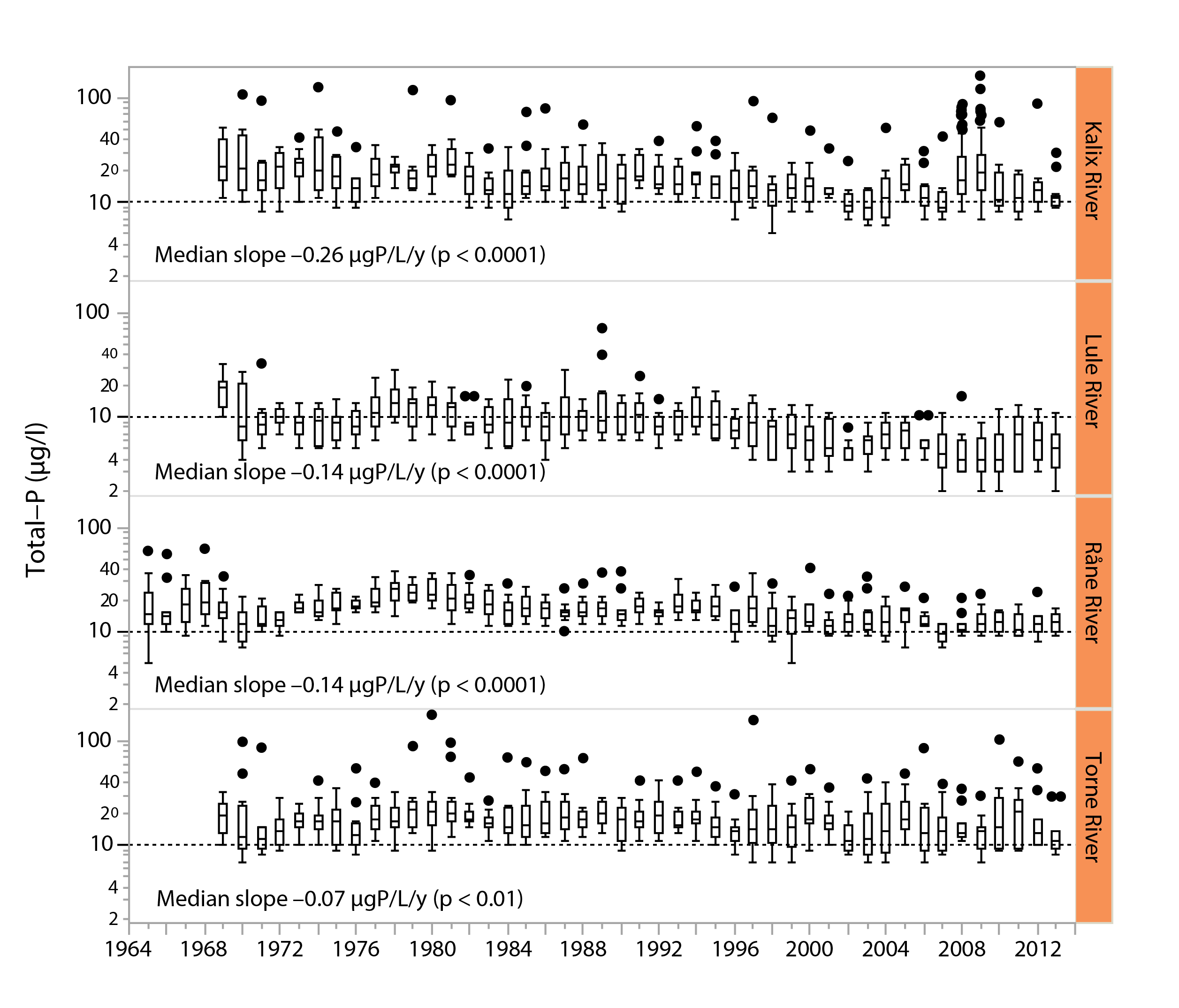
Figure 3-3 Long-term trends in total phosphorus water concentrations (μg/L) in four major, unregulated rivers that drain the subarctic Arctic/alpine ecoregion of the Scandinavian peninsula, the Kalix river, The Lule river, the Råne river, and the Torne river. Slopes and p-values are given in the different panels. Boxes indicate medians and 25th and 75th percentiles, while whiskers give the 10th and 90th percentiles. State of the Arctic Freshwater Biodiversity Report - Chapter 3 - Page 21 - Figure 3-3
-

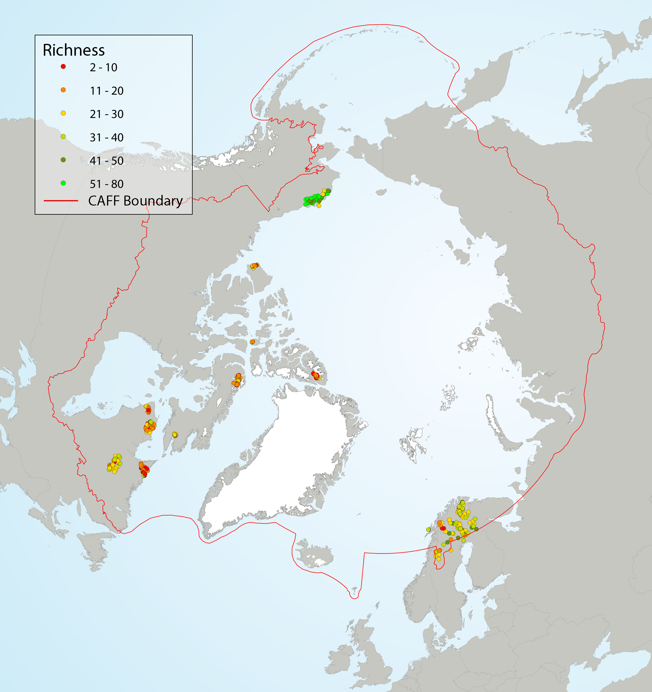
Local diatom species richness of Arctic diatom assemblages from stream scrapes, showing (left) richness as a function of latitude, and (right) site-specific richness. A LOESS smoother (blue line) with a span of 0.75 and a 95% confidence interval (grey shading) was applied to the data (left) to better highlight the general trend. Coloured circles on the map indicate species richness at the sampling sites. State of the Arctic Freshwater Biodiversity Report - Chapter 4 - Page 37 - Figure 4-10
-

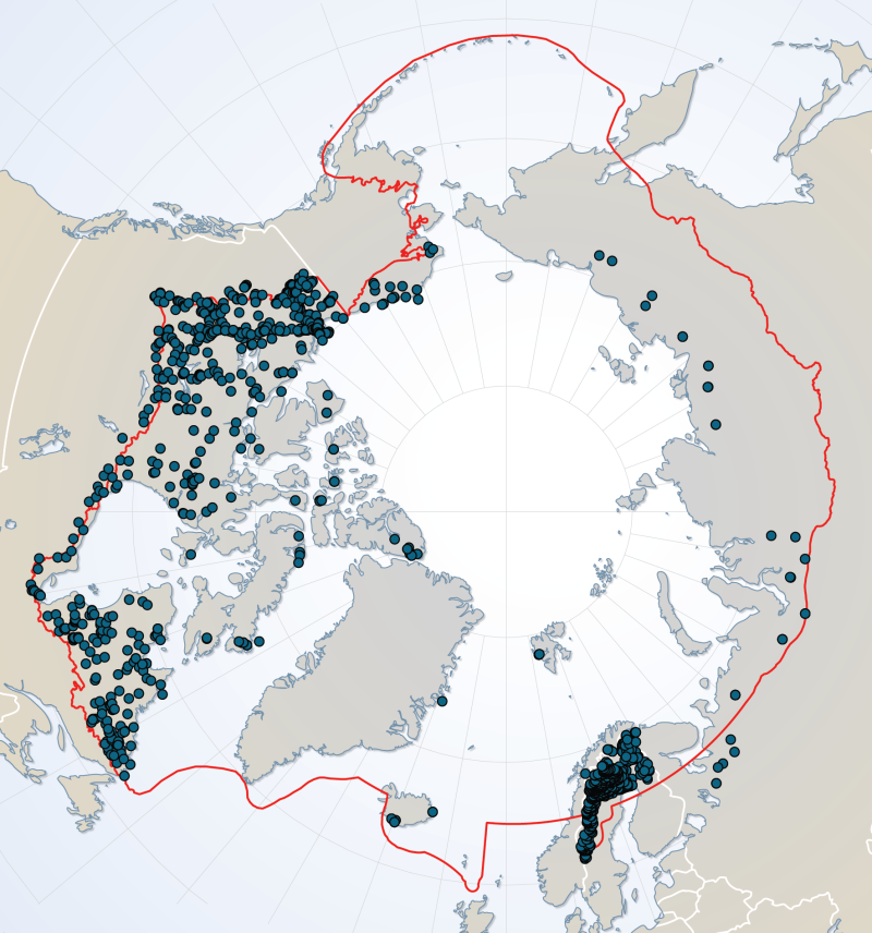
River dataset showing location of study sites in rivers for the Arctic Freshwater Biodiversity Monitoring Plan. Published in the Arctic Freshwater Monitoring Plan Brochure released in 2013 http://www.caff.is/monitoring-series/view_document/277-arctic-freshwater-biodiversity-monitoring-plan-brochure
 CAFF - Arctic Biodiversity Data Service (ABDS)