boundaries
Type of resources
Available actions
Topics
Keywords
Contact for the resource
Provided by
Years
Formats
Representation types
Update frequencies
status
Scale
-
Appendix 17.3. Phylogeographic and population genetics studies of selected Arctic species.
-

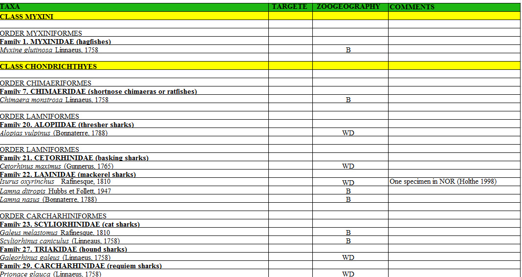
Marine fishes in the Arctic Ocean and adjacent seas (AOAS).
-
Appendix 11. Taxa of hetorotrophic protists reported from Foxe Basin, Canada (FB), Disko Bay, W Greenland (DB; Vors 1993), the Greenland Sea (GLS; Ikävalko & Gradinger 1997) and Northern Baffin Bay, Canada (NBB; Lovejoy et al. 2002).
-

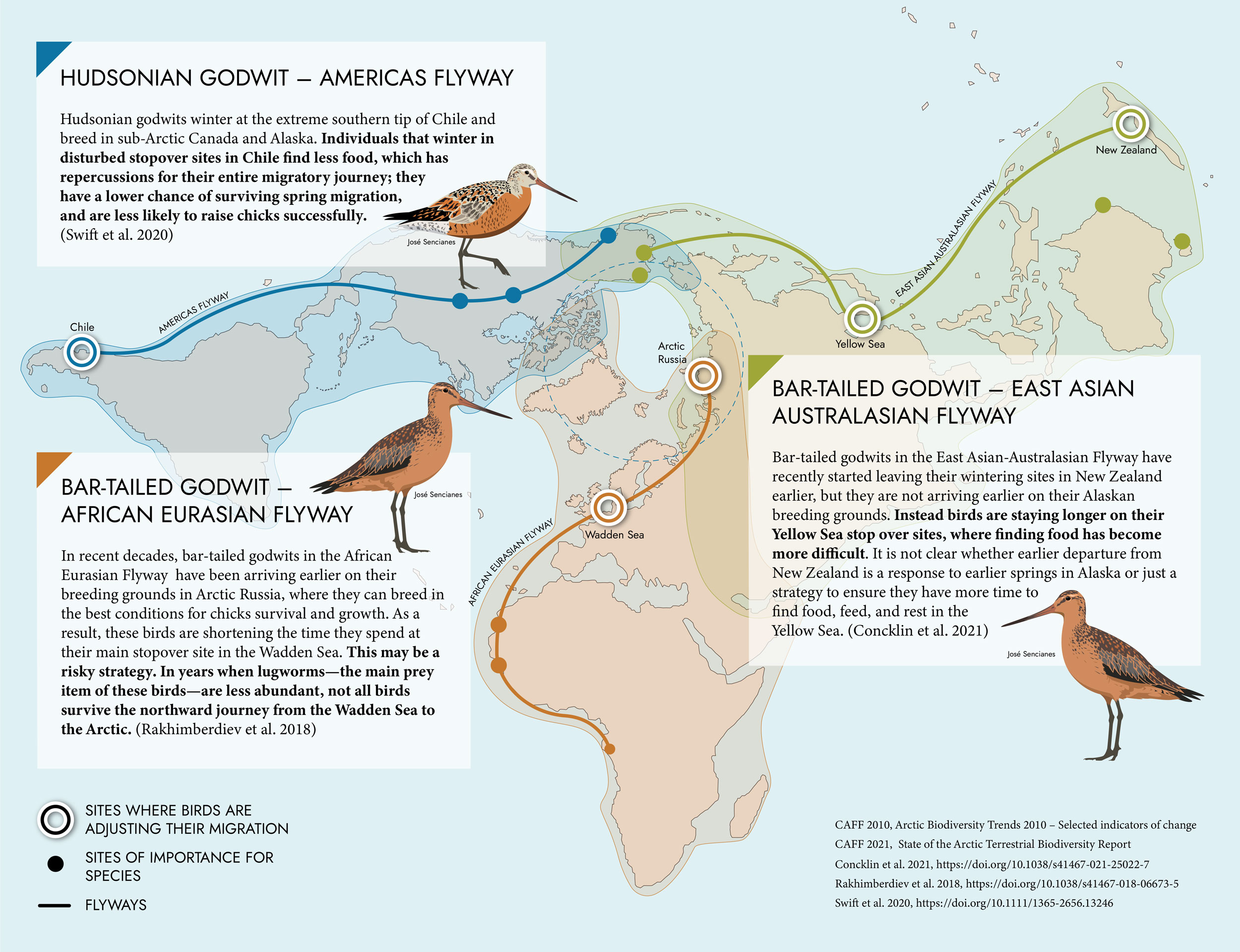
Shorebirds experience threats throughout their migratory journeys. Their Arctic breeding grounds are changing.
-

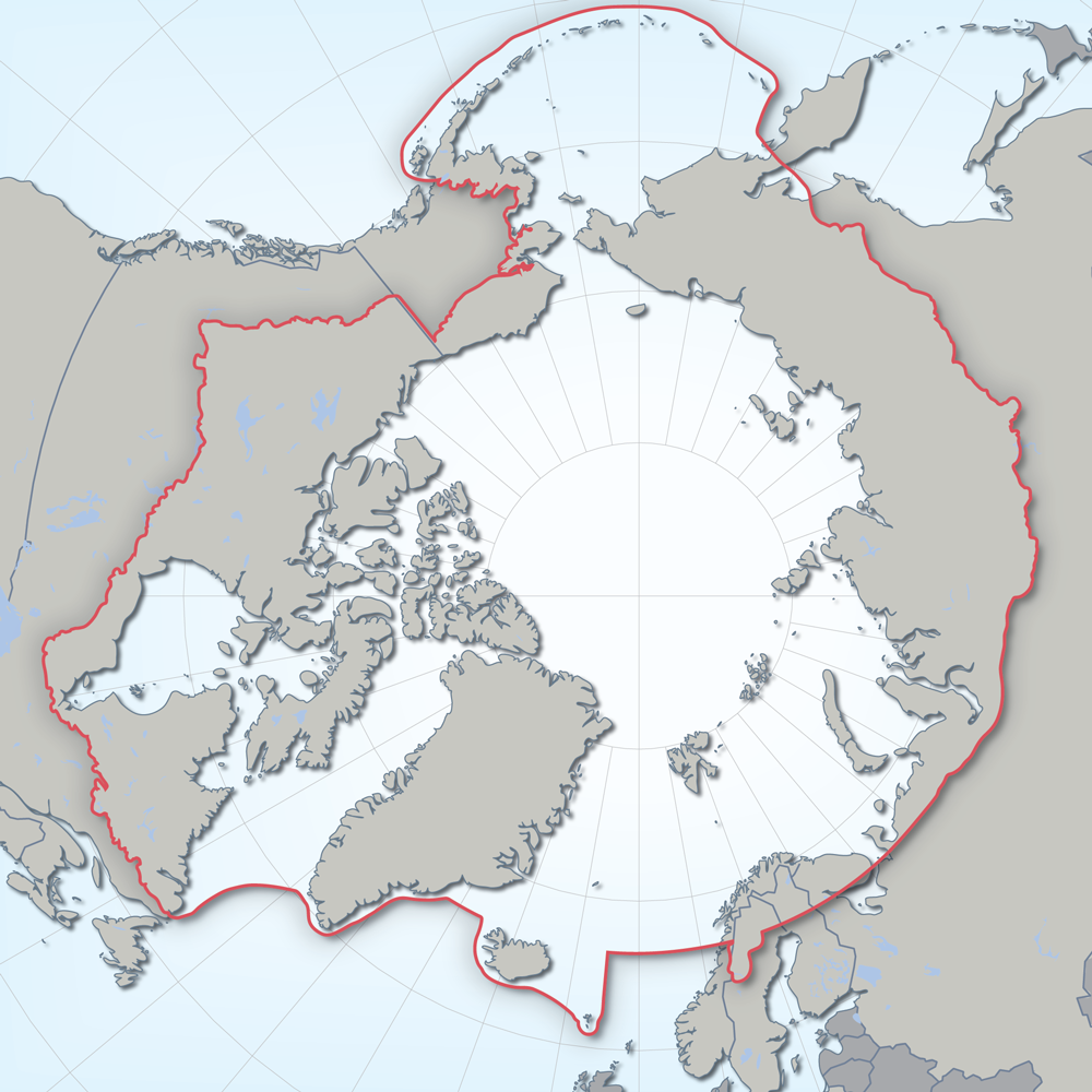
Defines the area covered by the the Conservation of Arctic Flora and Fauna (CAFF) working group of the Arctic Council. Each Arctic Council country was responsible for defining their Arctic boundary.
-
Appendix 9.1 List of all Arctic vascular plant species (with PAF code number) and their distribution in the 21 Arctic floristic provinces and 5 subzones based on Elven (2007).
-
Appendix 17.2. Cryptic speciation in selected Arctic terrestrial and marine species.
-
Appendix 9.4 Stabilized introductions (*) and casual introductions (**) among the vascular plants in the Arctic derived from Elven (2007) with indication of PAF code number. Arctic floristic provinces and subzones according to Elven (2007).
-
Appendix 6.1.1. Freshwater and diadromous fish species by area of occurrence within the High Arctic, Low Arctic and sub-Arctic. Appendix 6.1.2. Freshwater and diadromous fishes of the Palearctic and Nearctic regions. Appendix 6.1.3. Occurrence of freshwater and diadromous fishes in the Arctic and sub-Arctic regions of the seven geographical regions referred to in the main text. Appendix 6.1.4. Freshwater and diadromous fish species status summary for species assessed at some level of risk by country or region
-

Spider species-level data collected from pan traps across four habitat types in Cambrige Bay Nunavut. Two wet habitat types and two dry habitat types were examined. Samples continuously taken from July 3rd to August 11th 2014, but broken down into sampling periods which are, on average, 6 days long.
 CAFF - Arctic Biodiversity Data Service (ABDS)