 CAFF - Arctic Biodiversity Data Service (ABDS)
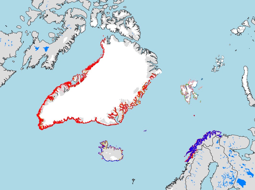
boundaries
Type of resources
Available actions
Topics
Keywords
Contact for the resource
Provided by
Years
Formats
Representation types
Update frequencies
status
Scale
-
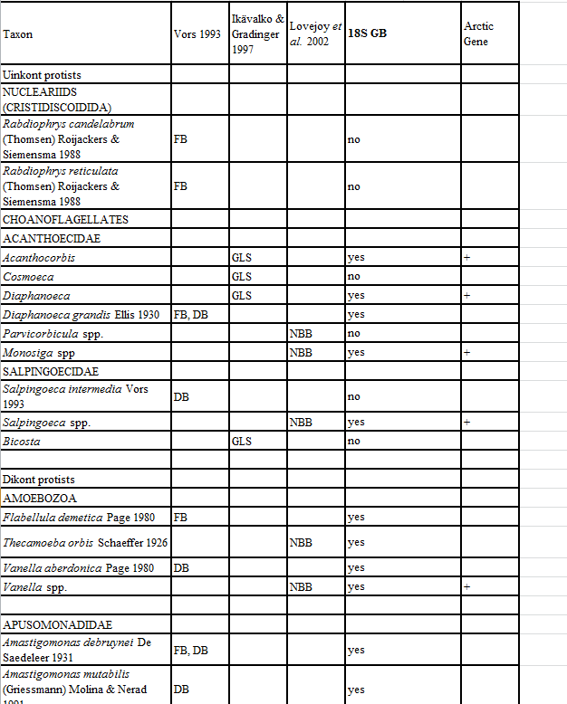
Appendix 11. Taxa of hetorotrophic protists reported from Foxe Basin, Canada (FB), Disko Bay, W Greenland (DB; Vors 1993), the Greenland Sea (GLS; Ikävalko & Gradinger 1997) and Northern Baffin Bay, Canada (NBB; Lovejoy et al. 2002).
-
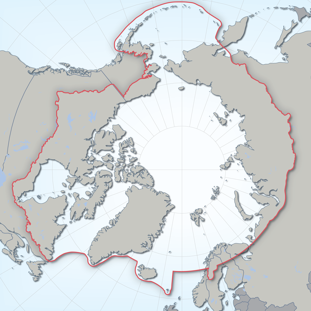
Defines the area covered by the the Conservation of Arctic Flora and Fauna (CAFF) working group of the Arctic Council. Each Arctic Council country was responsible for defining their Arctic boundary.
-
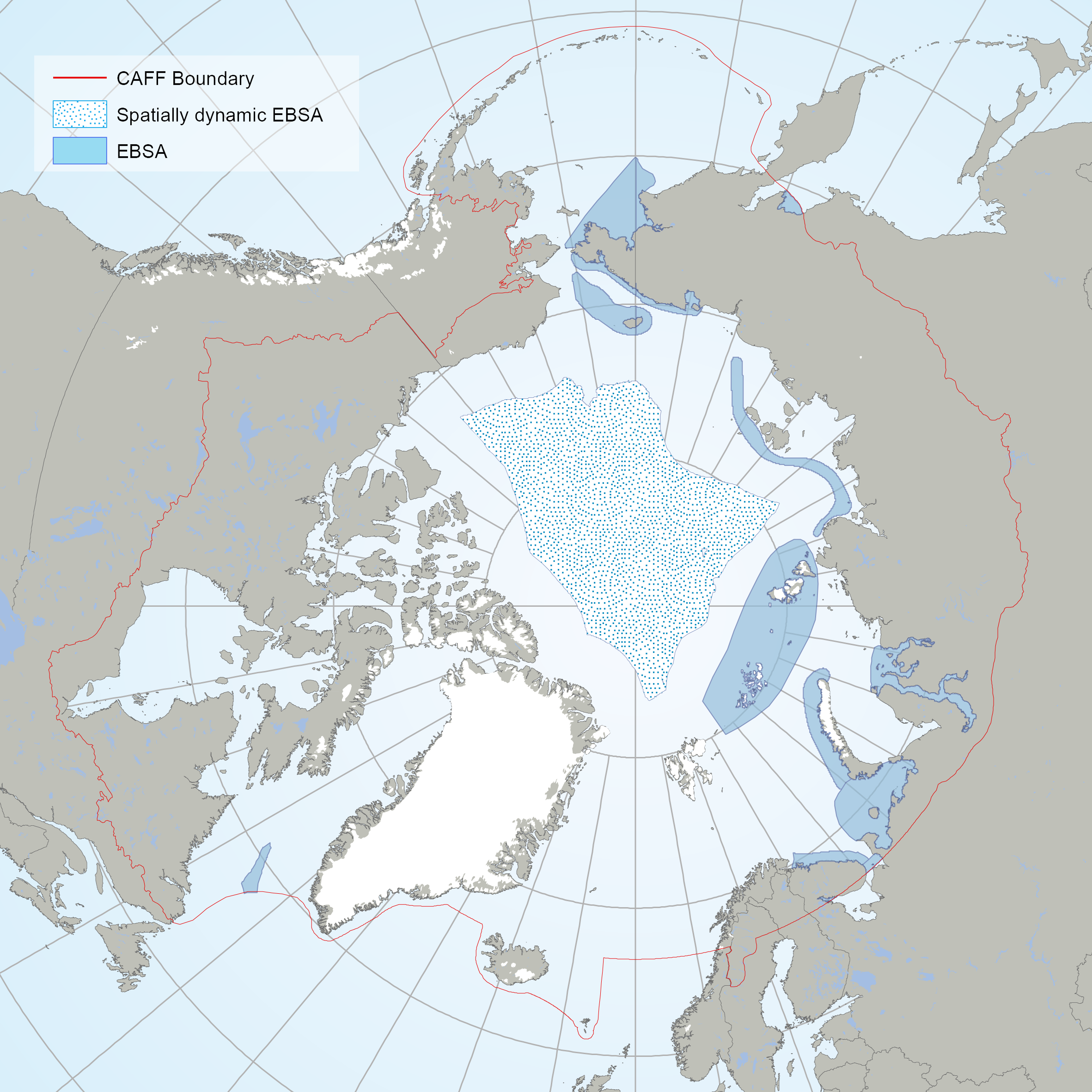
The EBSAs are special areas in the ocean that serve important purposes, in one way or another, to support the healthy functioning of oceans and the many services that it provides. The EBSAs contained din this dataset are the result of an Arctic Regional Workshop to Facilitate the Description of Ecologically or Biologically Significant Marine Areas (EBSAs) held in Finland on 3-7 march, 2014. <a href="https://www.cbd.int/ebsa/ebsas" target="_blank">Resource</a>
-

Locations and associated attributes of circumpolar Muskox studies. Attributes include animal count, population estimate, estimate error and associated report citation.
-
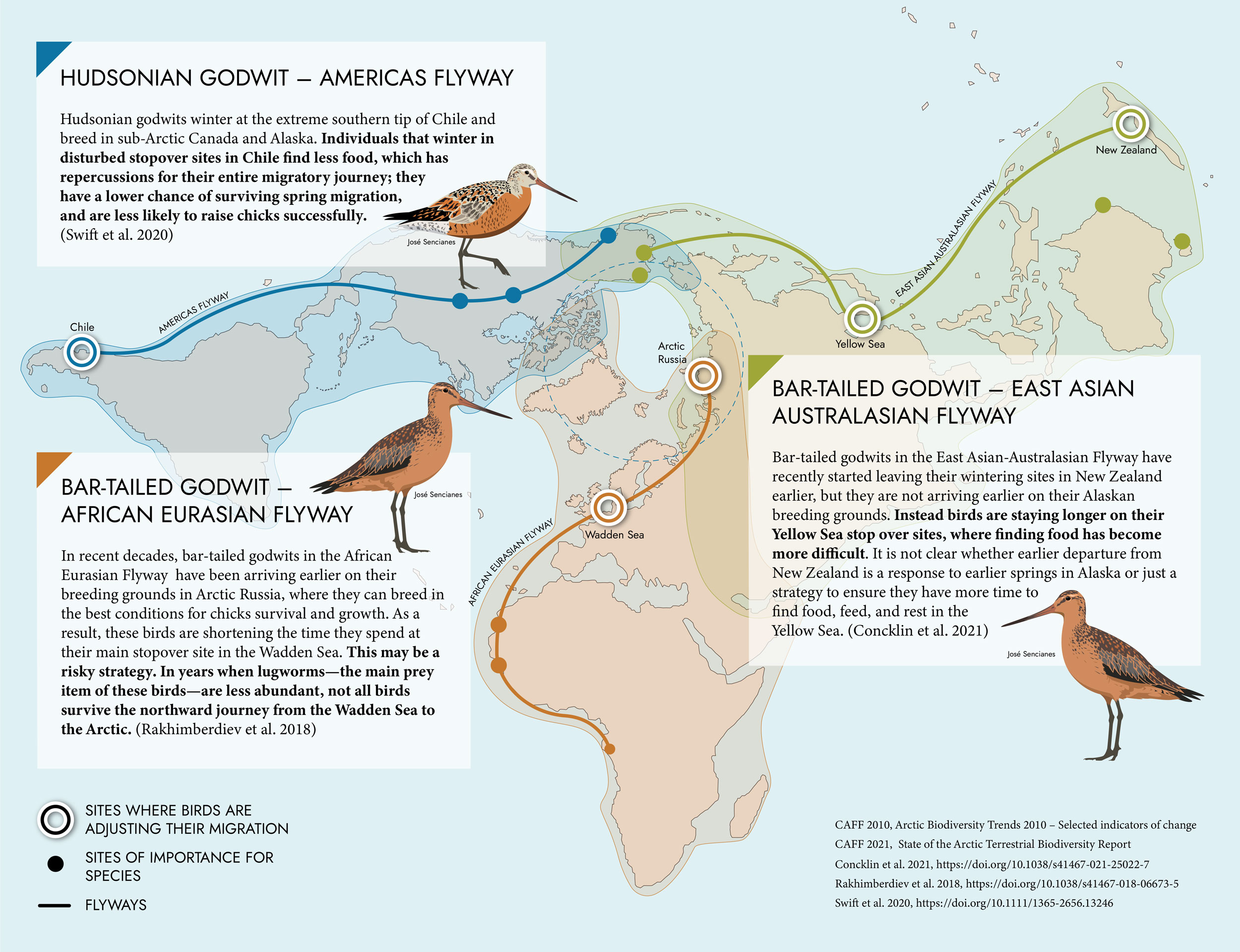
Shorebirds experience threats throughout their migratory journeys. Their Arctic breeding grounds are changing.
-

Spider species-level data collected from pan traps across four habitat types in Cambrige Bay Nunavut. Two wet habitat types and two dry habitat types were examined. Samples continuously taken from July 3rd to August 11th 2014, but broken down into sampling periods which are, on average, 6 days long.
-
Standardized metadata template, for identifying knowledge locations on Arctic Coastal Ecosystems applicable for different knowledge systems. This template was developed by the Nordic Coastal Group, composed of the Nordic representatives on CBMP Coastal. The template is intended to identify locations for Indigenous Knowledge, Scientific, Hunters Knowledge, Local Knowledge, and community-based monitoring. The template is composed of two files a Word document that provides the rationale and detailed description for the Excel sheet that allows for standardized data gathering
-
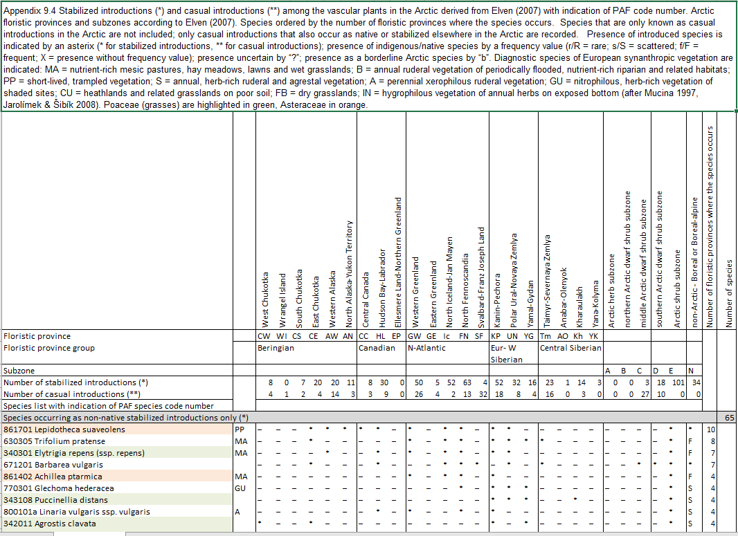
Appendix 9.4 Stabilized introductions (*) and casual introductions (**) among the vascular plants in the Arctic derived from Elven (2007) with indication of PAF code number. Arctic floristic provinces and subzones according to Elven (2007).
-
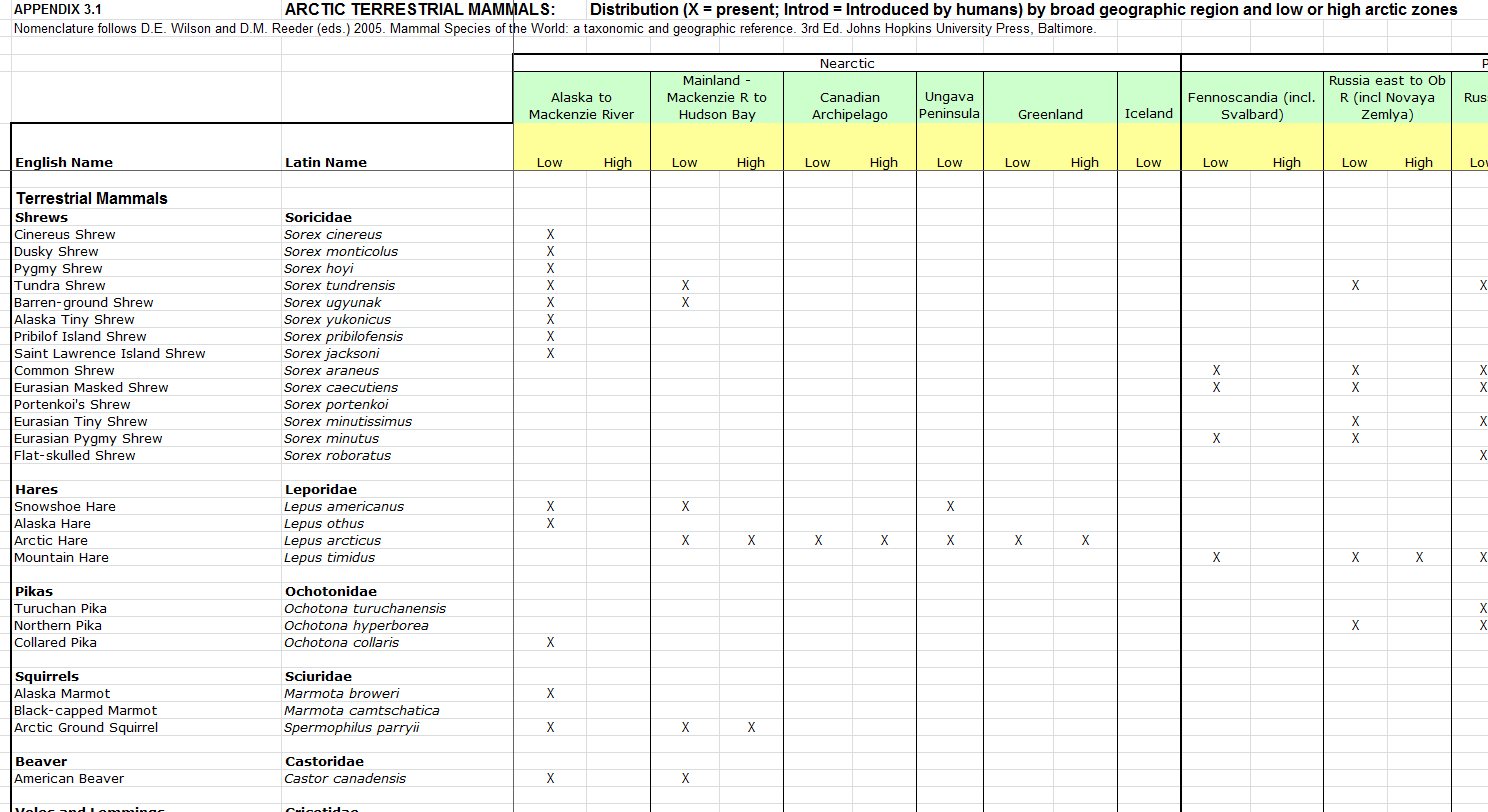
Distribution by broad geographic region and low or high arctic zones.
-
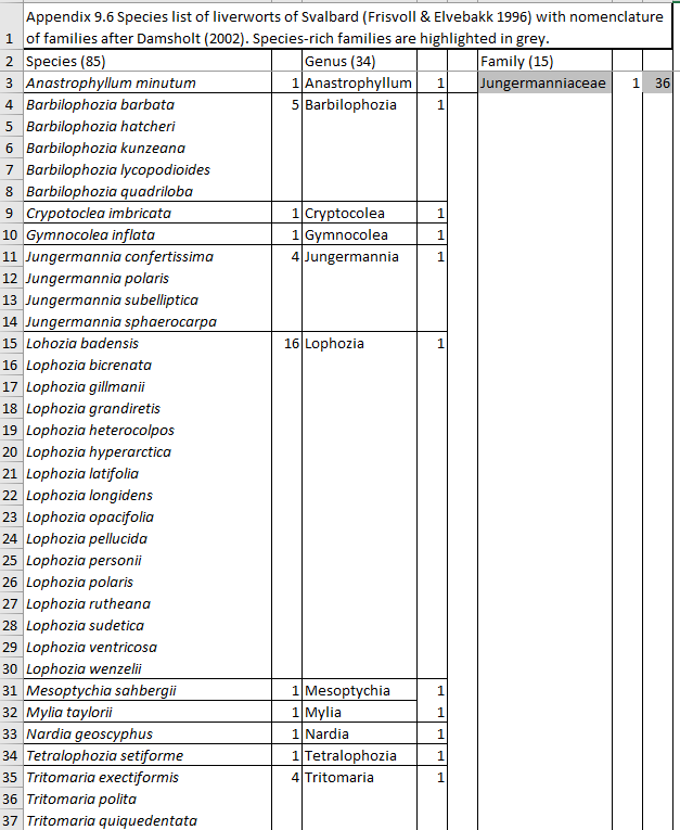
Appendix 9.6 Species list of liverworts of Svalbard (Frisvoll & Elvebakk 1996) with nomenclature of families after Damsholt (2002).