PAME
Type of resources
Available actions
Topics
Keywords
Contact for the resource
Provided by
Years
Representation types
Update frequencies
status
Scale
-

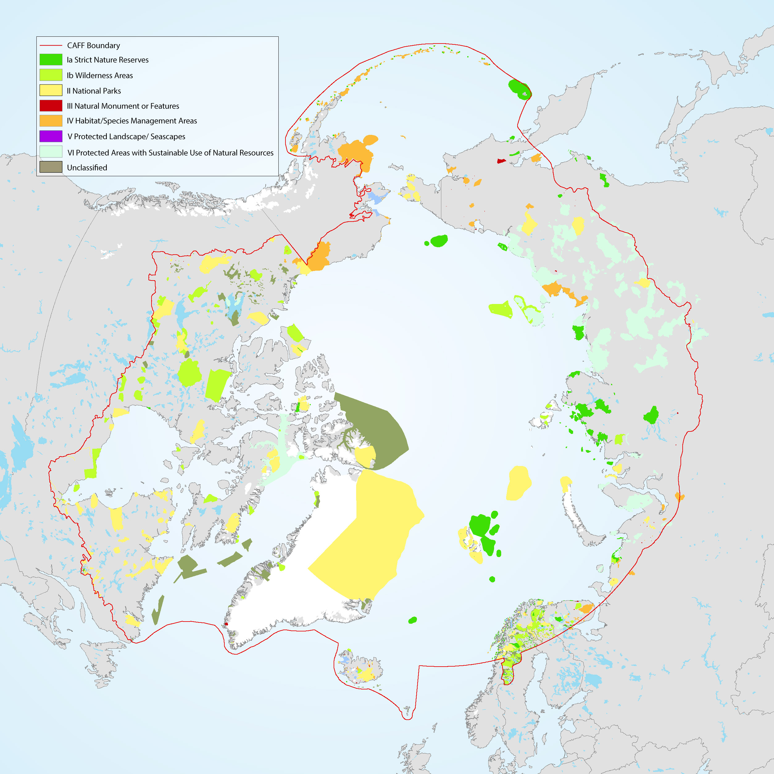
The Conservation of Arctic Flora and Fauna (CAFF) and Protection of the Arctic Marine Environment (PAME) working groups of the Arctic Council developed this update on the 2017 indicator report (CAFF-PAME 2017). It provides an overview of the status and trends of protected areas in the Arctic and an overview of Other Effective area-based Conservation Measures. The data used represents the results of the 2020 update to the Arctic Protected Areas Database submitted by each of the Arctic Council member states.
-

For the background of data production and data interpretation we refer to the PAME report “Modelling Arctic oceanographic connectivity to further develop PAME’s MPA toolbox”. The uploaded data consist of two main types: 1. Connectivity matrices describing the seascape connectivity in the model domain consisting of 40893 model grid cells. The connectivity matrices describe the probability of dispersal between any two selected model grid cells. 2. GIS shape files of dispersal distance (km) from each model grid cell within the model domain.
-

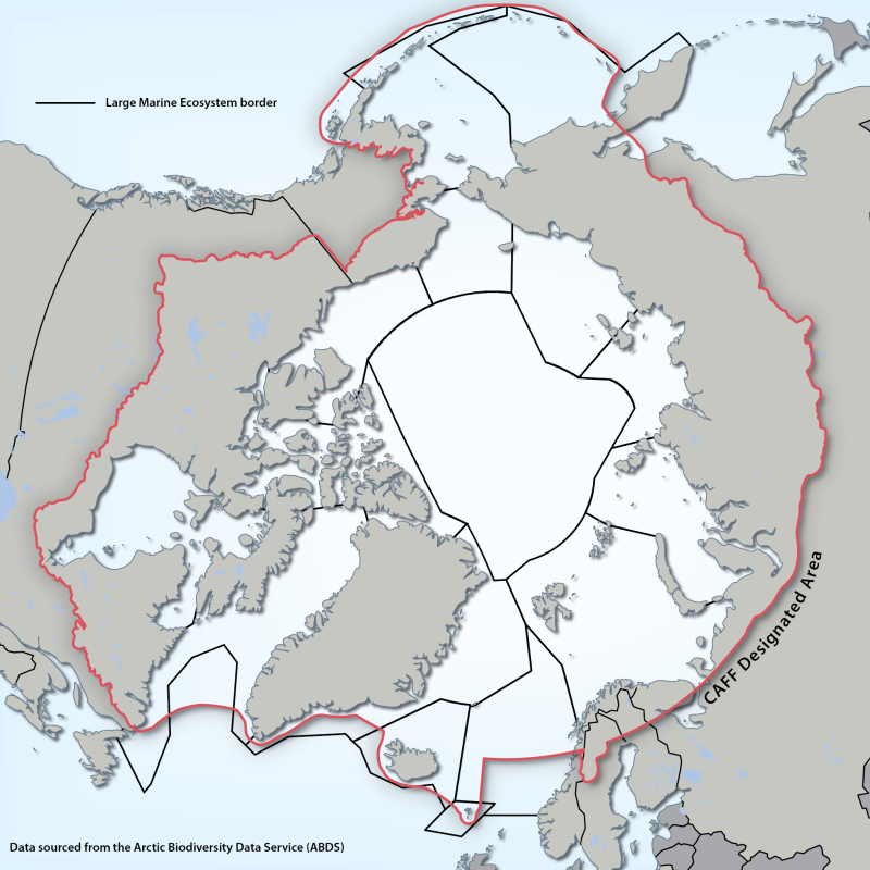
Large Marine Ecosystems (LMEs) are regions of ocean space encompassing coastal areas from river basins and estuaries to the seaward boundary of continental shelves and the seaward margins of coastal current systems. Fifty of them have been identified. They are relatively large regions (200 000 km2 or more) characterized by distinct bathymetry, hydrography, productivity and trophically dependent populations. The LME approach uses five modules: 1. productivity module considers the oceanic variability and its effect on the production of phyto and zooplankton 2. fish and fishery module concerned with the sustainability of individual species and the maintenance of biodiversity 3. pollution and ecosystem health module examines health indices, eutrophication, biotoxins, pathology and emerging diseases 4. socio-economic module integrates assessments of human forcing and the long-term sustainability and associated socio-economic benefits of various management measures, and 5. governance module involves adaptive management and stakeholder participation.” Source: http://www.fao.org/fishery/topic/3440/en Reference: Sherman, K. and Hempel, G. (Editors) 2009. The UNEP Large Marine Ecosystem Report: A perspective on changing conditions in LMEs of the world’s Regional Seas. UNEP Regional Seas Report and Studies No. 182. United Nations Environment Programme. Nairobi, Kenya. Data available from: http://lme.edc.uri.edu/ - LMEs of the world Updated shape file - 2014
-

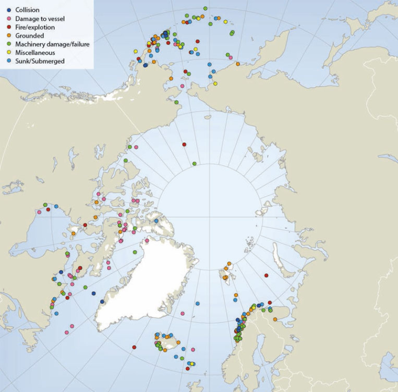
Locations of sub-Arctic and Arctic shipping accidents and incident causes, 1995-2004 (source: Arctic Marine Shipping Assessment 2009). Published in the Arctic Biodiversity Assessment (ABA) released in 2014.
-

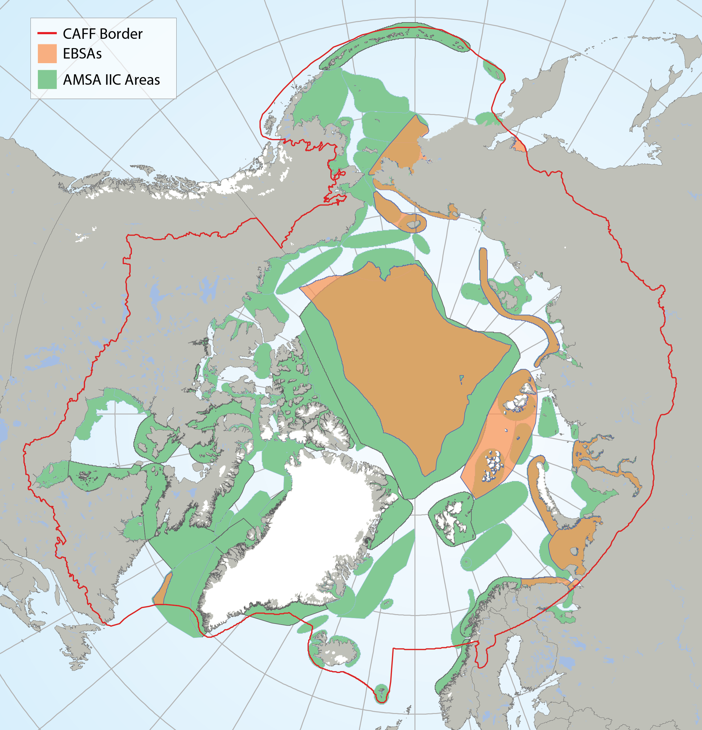
Arctic Ecologically and Biologically Significant Areas (EBSAs) and Arctic Marine Areas of Heightened Ecological and Cultural Significance as identified in the Arctic Marine Shipping Assessment (AMSA) IIC report. STATE OF THE ARCTIC MARINE BIODIVERSITY REPORT - <a href="https://arcticbiodiversity.is/marine" target="_blank">Chapter 1</a> - Page 16 - Box Figure 1.1
 CAFF - Arctic Biodiversity Data Service (ABDS)