 CAFF - Arctic Biodiversity Data Service (ABDS)
irregular
Type of resources
Available actions
Topics
Keywords
Contact for the resource
Provided by
Years
Formats
Representation types
Update frequencies
status
Scale
-
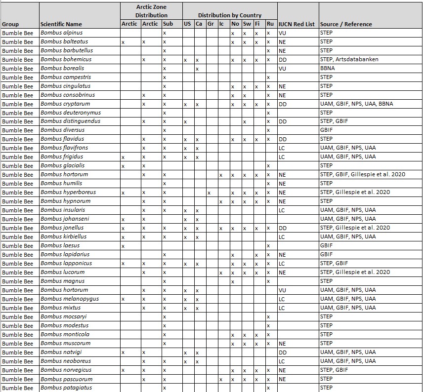
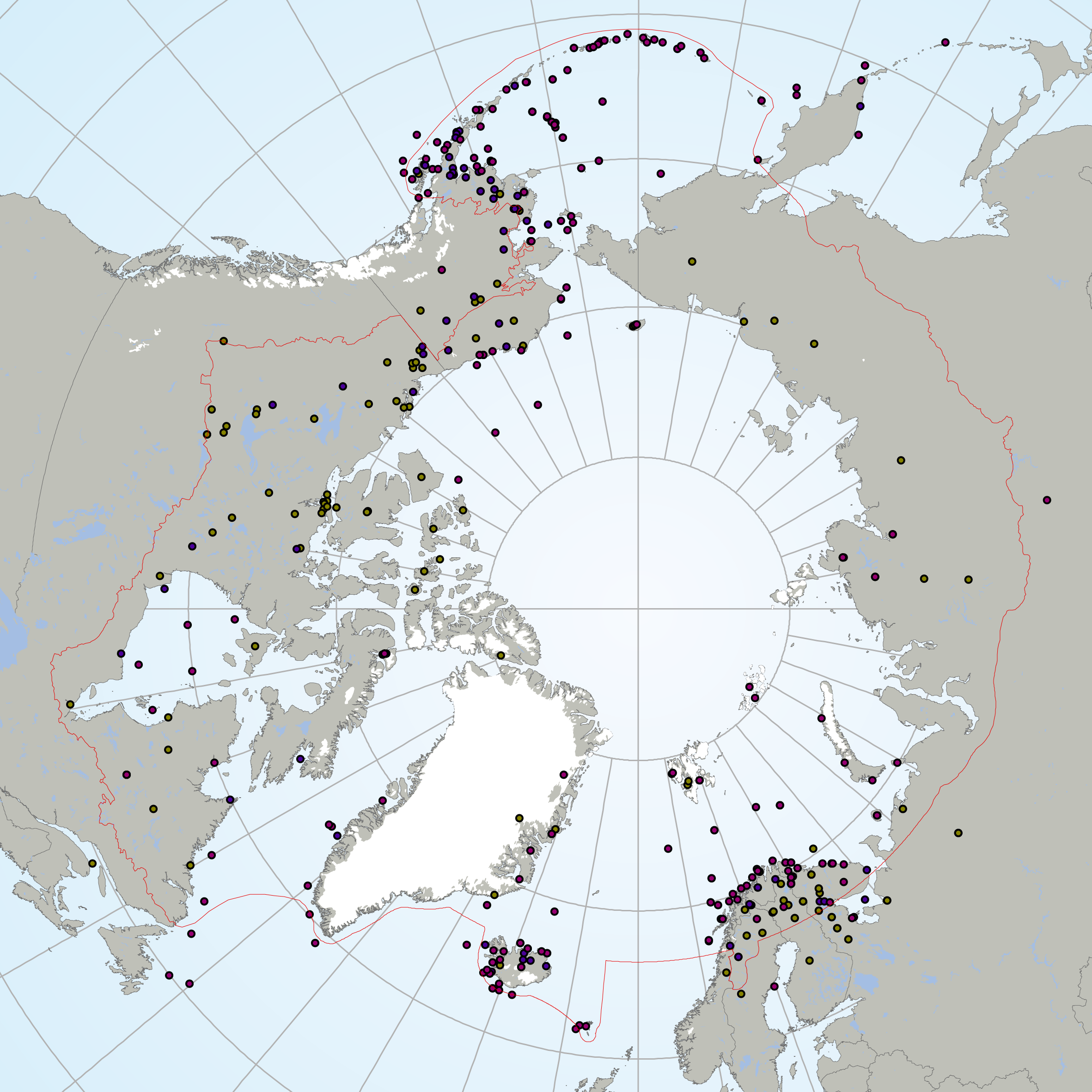
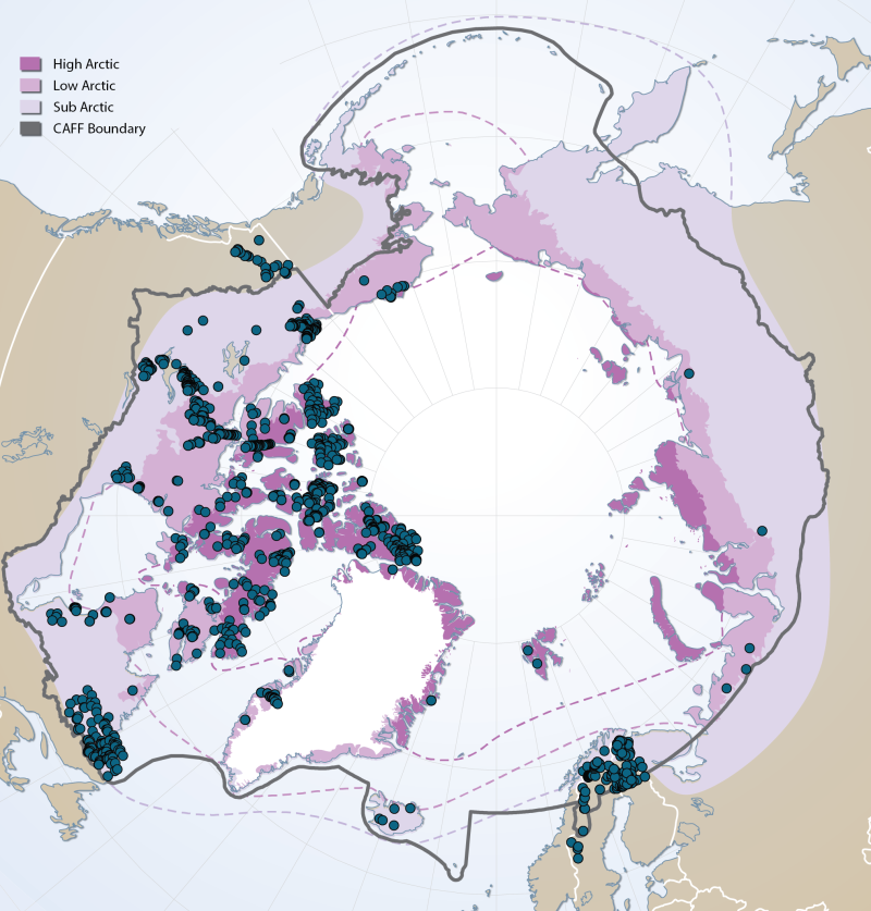
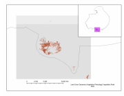
Known species from the High Arctic, Low Arctic, and Sub-Arctic, based on records from 1990 to 2022. Additional unknown species are likely present. Geographical Distribution Includes Arctic regions of eight political jurisdictions. Associated article is published in the 2022 Arctic Report Card essay entitled Arctic Pollinators by Burns et al.
-
The Circumpolar Biodiversity Monitoring Program, a cornerstone programme of the Conservation of Arctic Flora and Fauna (CAFF), Arctic Council working Group is an international network of scientists, government agencies, Indigenous organizations and conservation groups working together to harmonize and integrate efforts to monitor the Arctic's living resources.CBMP experts are developing four coordinated and integrated Arctic Biodiversity Monitoring Plans to help guide circumpolar monitoring efforts. Results will be channeled into effective conservation, mitigation and adaptation policies supporting the Arctic. These plans represent the Arctic's major ecosystems(Marine, Freshwater, Coastal, Terrestrial). It is important that monitoring programs develop the most effective reporting strategies if they are to inform decision making. To facilitate effective and consistent reporting, the CBMP has chosen a suite of indices and indicators that provide a comprehensive picture of the state of Arctic biodiversity – from species to habitats to ecosystem processes to ecological services. These indices and indicators are developed in a hierarchical manner, allowing users to drill down into the data from the higher-order indices to more detailed indicators. These are being developed through an expert consultation process. The Arctic Species Trend Index (ASTI) is part of this suite of indicators and indices developed by CAFFs CBMP. It tracks trends in over 300 Arctic vertebrate species and comprises the Arctic component of the Living Planet Index. It is important to identify how wildlife and ecosystems are changing in order to develop effective conservation and adaptation strategies in the Arctic, an environment undergoing dramatic changes. The ASTI describes overall trends across species, taxonomy, ecosystems, regions and other categories.
-
<a href="http://caff.is/strategies-series/359-the-alaska-yukon-region-of-the-circumboreal-vegetation-map-cbvm" target="_blank"> <img width="150px" height="150px" alt="logo" align="left" hspace="10px" src="http://geo.abds.is/geonetwork/images/flora_logo.png"> </a>A map of boreal vegetation for the Alaska-Yukon region was developed to contribute to the circumboreal vegetation mapping (CBVM) project. The effort included developing a map of bioclimates with 12 bioclimate zones, a map of biogeographic provinces with Alaska-Yukon and Aleutian provinces, and a map of geographic sectors with six sectors that provided the basis for classification of boreal vegetation. Vegetation mapping was done at 1:7.5 million scale using the mapping protocols of the CBVM team. Mapping used MODIS imagery as the basis for manual image interpretation and an integrated-terrain-unit approach, which included classifications for bioclimate, physiography, generalized geology, permafrost, disturbance, growth from, geographic sector, and vegetation. Vegetation was mapped at two hierarchical levels: (1) formation group differentiating zonal and azonal systems; and (2) geographic sectors based on bioclimatic zonation and dominant species that characterize broad longitudinal regions or biogeographic provinces. Each of the 19 map units was described by identifying the dominant and characteristic species and its climatic and landscape characteristics, as well as references that relate to the unit.
-
Sites of existing lake biotic and abiotic data as compiled by the Freshwater Expert Monitoring Group (FEMG) of the Circumpolar Biodiversity Monitoring Group (CBMP) Published in the CBMP Freshwater Brochure 2013 https://oaarchive.arctic-council.org/items/e76cce2c-4c87-4eb4-89d3-c88c3ae955d6
-
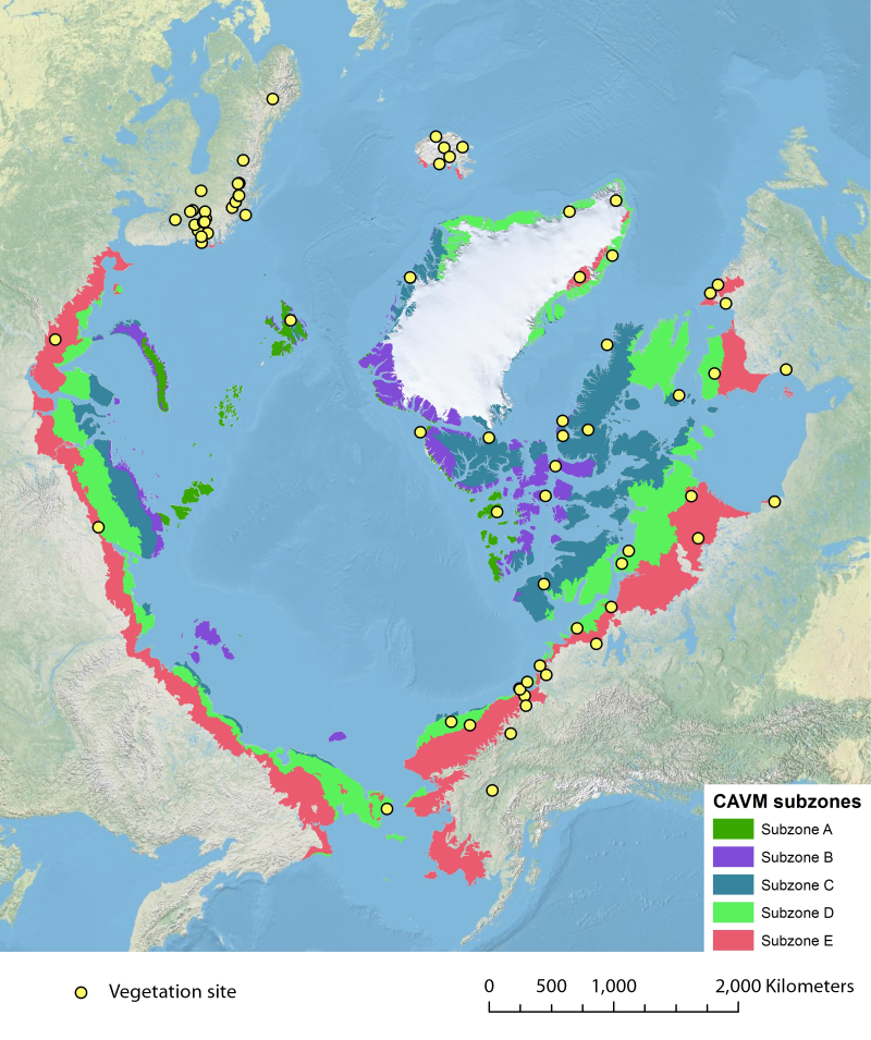
Location of long-term vegetation (including fungi, non-vascular and vascular plants) monitoring sites and programs. Comes from the Arctic Terrestrial Biodiversity Monitoring Plan is developed to improve the collective ability of Arctic traditional knowledge holders, northern communities and scientists to detect, understand and report on long-term change in Arctic terrestrial ecosystems and biodiversity. The report can be seen here http://www.caff.is/publications/view_document/256-arctic-terrestrial-biodiversity-monitoring-plan The monitoring locations are place over the Circumpolar Arctic bioclimate subzones (CAVM Team 2003) http://www.caff.is/flora-cfg/circumpolar-arctic-vegetation-map
-
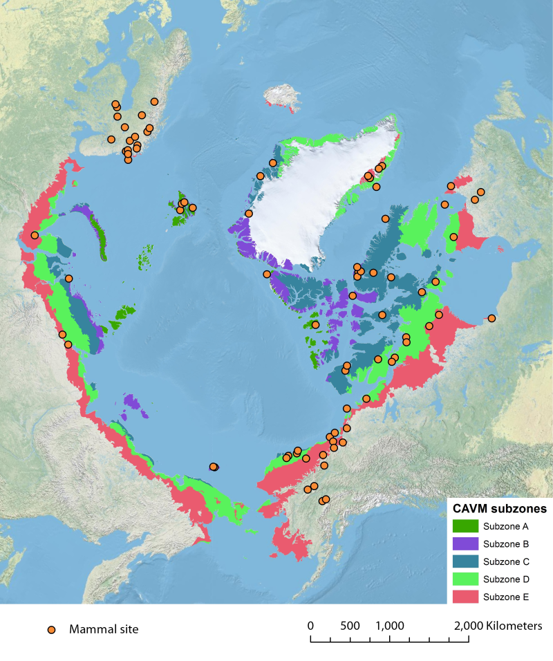
Location of long-term mammal monitoring sites and programs. Comes from the Arctic Terrestrial Biodiversity Monitoring Plan is developed to improve the collective ability of Arctic traditional knowledge holders, northern communities and scientists to detect, understand and report on long-term change in Arctic terrestrial ecosystems and biodiversity..
-
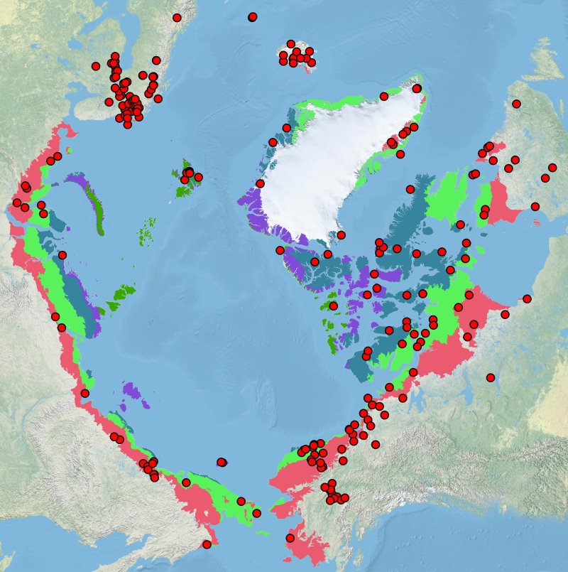
The Arctic Terrestrial Biodiversity Monitoring Plan is developed to improve the collective ability of Arctic traditional knowledge holders, northern communities and scientists to detect, understand and report on long-term change in Arctic terrestrial ecosystems and biodiversity.
-
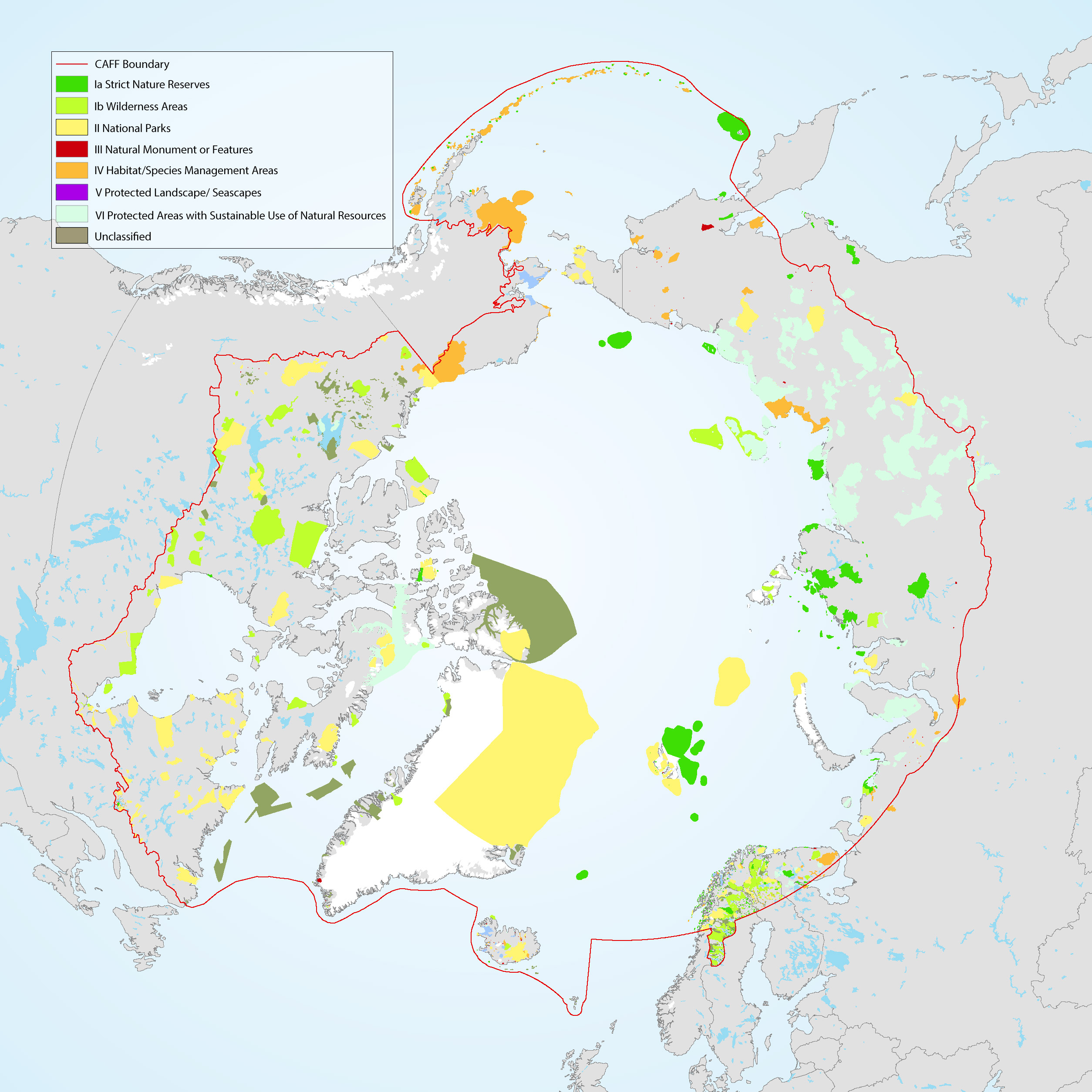
The Conservation of Arctic Flora and Fauna (CAFF) and Protection of the Arctic Marine Environment (PAME) working groups of the Arctic Council developed this update on the 2017 indicator report (CAFF-PAME 2017). It provides an overview of the status and trends of protected areas in the Arctic and an overview of Other Effective area-based Conservation Measures. The data used represents the results of the 2020 update to the Arctic Protected Areas Database submitted by each of the Arctic Council member states.
-
The Land Cover Dynamics MODIS product is a yearly product that represents thetiming of vegetation phenology globally. Sub-datasets include vegetation growth, maturity,senescence, and dormancy. This product also includes the NBAR-(Nadir Bidirectionalreflectance distribution function (BRDF) adjusted Reflectance) based EVI, in part becausethe EVI is used to create the Land Cover Dynamics. The Land Cover Dynamics product uses both Terra and Aqua MODIS data. Version005 (provided) has a 500 m spatial resolution, which is an improvement from the 1,000 mversion 004 product. This product is only available in MODIS tiles, so the tiles needed tocover the CAFF pan-Arctic region has been downloaded but not clipped to the pan-Arcticextent at this time.
-
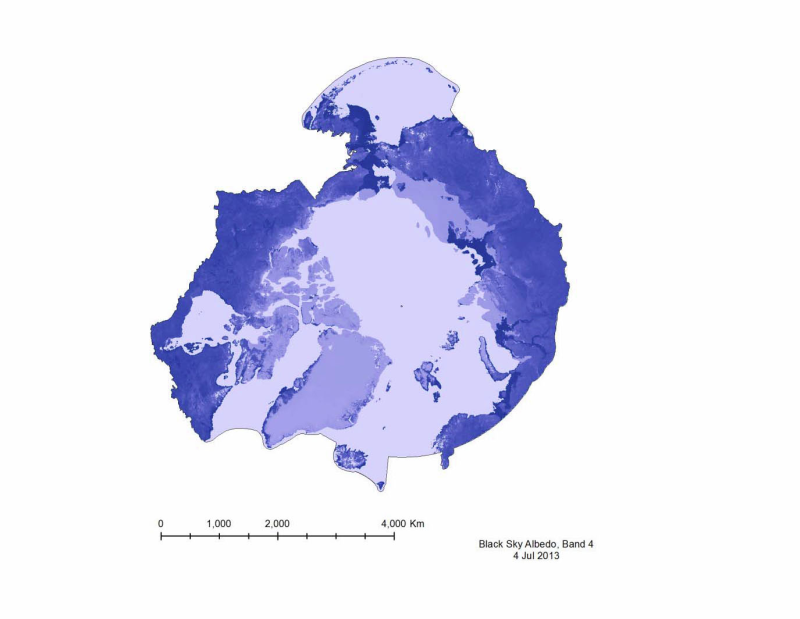
Albedo is a reflection coefficient that describes the reflecting power of a surface. Data compiled for CAFFs Land Cover Change Initiative with dataset for the firs of very month during 2001- 20112. - <a href="http://www.caff.is/indices-and-indicators/land-cover-change-index" target="_blank"> Land Cover Change Initiative (LCC)</a>