Boundaries
Type of resources
Available actions
Topics
Keywords
Contact for the resource
Provided by
Years
Formats
Representation types
Update frequencies
status
Scale
-
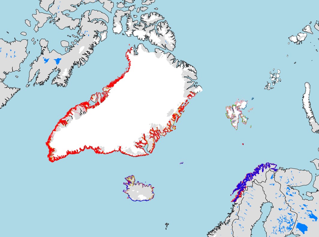
Standardized metadata template, for identifying knowledge locations on Arctic Coastal Ecosystems applicable for different knowledge systems. This template was developed by the Nordic Coastal Group, composed of the Nordic representatives on CBMP Coastal. The template is intended to identify locations for Indigenous Knowledge, Scientific, Hunters Knowledge, Local Knowledge, and community-based monitoring. The template is composed of two files a Word document that provides the rationale and detailed description for the Excel sheet that allows for standardized data gathering
-
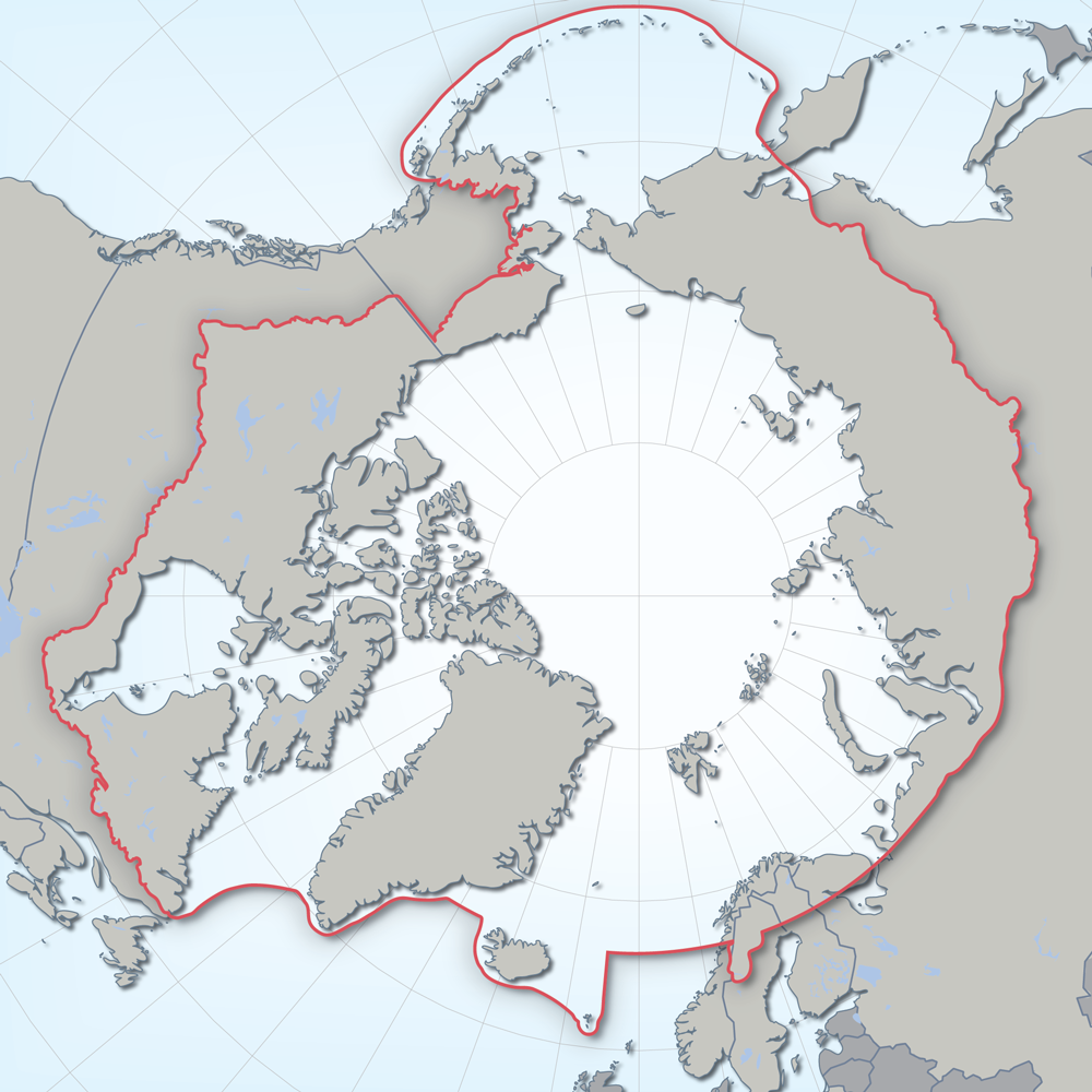
Defines the area covered by the the Conservation of Arctic Flora and Fauna (CAFF) working group of the Arctic Council. Each Arctic Council country was responsible for defining their Arctic boundary.
-
Appendix 9.1 List of all Arctic vascular plant species (with PAF code number) and their distribution in the 21 Arctic floristic provinces and 5 subzones based on Elven (2007).
-

Locations and associated attributes of circumpolar Muskox studies. Attributes include animal count, population estimate, estimate error and associated report citation.
-

Spider species-level data collected from pan traps across four habitat types in Cambrige Bay Nunavut. Two wet habitat types and two dry habitat types were examined. Samples continuously taken from July 3rd to August 11th 2014, but broken down into sampling periods which are, on average, 6 days long.
-
Distribution by broad geographic region and low or high arctic zones.
-

Within the CAFF boundary there are 92 protected areas recognised under global international conventions. These include 12 World Heritage sites3 (three of which have a marine component) and 80 Ramsar sites, which together cover 0.9% (289,931 km2) of the CAFF area (Fig. 4). Between 1985 and 2015, the total area covered by Ramsar sites4 almost doubled, while the total area designated as World Heritage sites increased by about 50% in the same time period (Fig. 5). ARCTIC PROTECTED AREAS - INDICATOR REPORT 2017
-
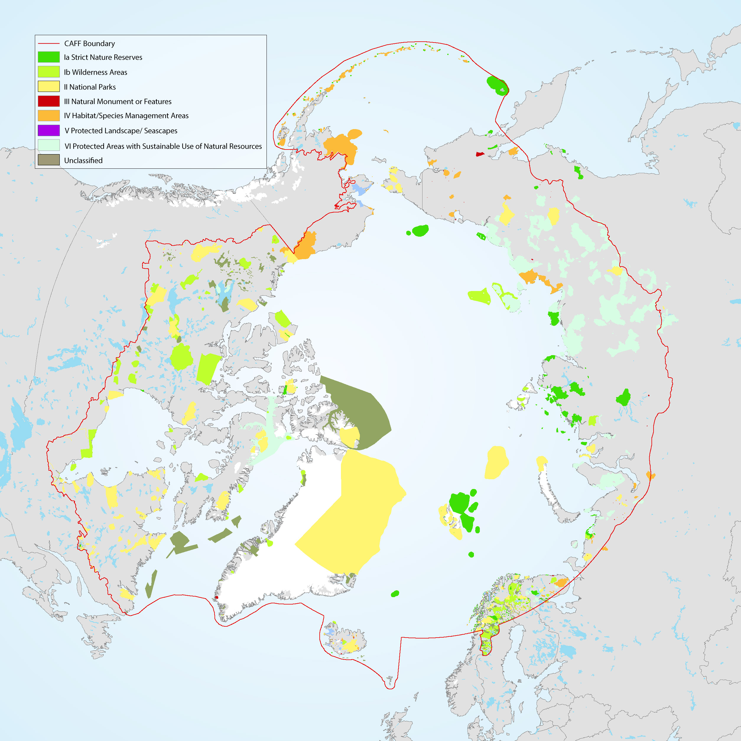
The Conservation of Arctic Flora and Fauna (CAFF) and Protection of the Arctic Marine Environment (PAME) working groups of the Arctic Council developed this update on the 2017 indicator report (CAFF-PAME 2017). It provides an overview of the status and trends of protected areas in the Arctic and an overview of Other Effective area-based Conservation Measures. The data used represents the results of the 2020 update to the Arctic Protected Areas Database submitted by each of the Arctic Council member states.
-
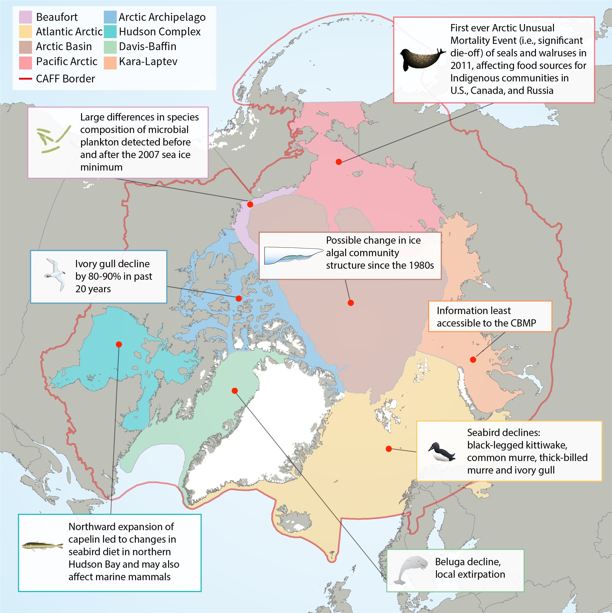
Map of Arctic Marine Areas as defined by the Circumpolar Biodiversity Monitoring Program (CBMP), with one sample finding from each area.
-
Appendix 9.6 Species list of liverworts of Svalbard (Frisvoll & Elvebakk 1996) with nomenclature of families after Damsholt (2002).
 CAFF - Arctic Biodiversity Data Service (ABDS)